Quantcast
Channel: Pinoy Mountaineer
Viewing all 613 articles
Browse latest View live

Mt. Bloomfield (787+) in Puerto Princesa, Palawan

$
0
0
MT. BLOOMFIELD
Puerto Princesa, Palawan
Major jumpoff: Sabang Beach, Puerto Princesa
LLA: 10°11′47.8′′N 118°52′19.2′′ E, 787 MASL (+787m)
Days required / Hours to summit: 1 day / 3-4 hours
Specs: Minor climb, Difficulty 4/9, Trail class 1-4
Features: Ultramafic forests, scenic coastal views
Article created: August 19, 2014
Last updated: August 19, 2014

BACKGROUND
One of Puerto Princesa's beautiful mountains, and one that is conveniently accessible to visitors of the famed Underground River, with its trail starting from Sabang beach itself, Mt. Bloomfield offers the unique opportunity of trekking on a mountain that lies within a UNESCO World Heritage Site.

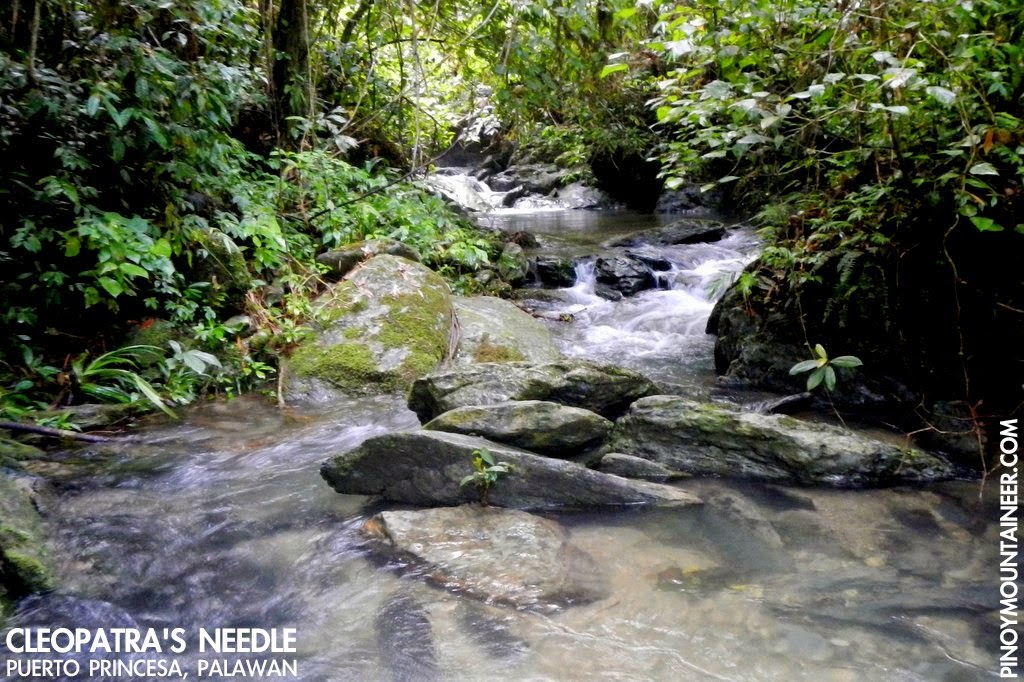
The trek starts from Sabang beach itself, and after a brief march through agricultural lands, the trail quickly turns rocky, until you reach the purely ultramafic slopes that lead up to the mountain. As is the case elsewhere in Palawan, these rocks are actually nice to walk through, and are not very slippery.

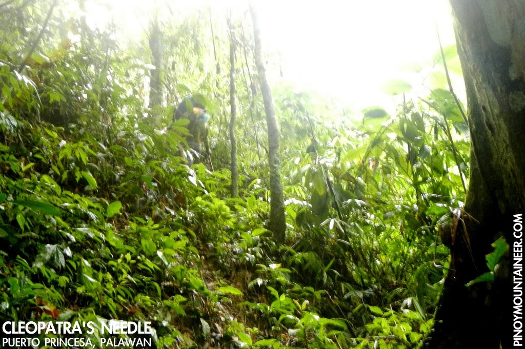
A view of the sea that faces Sabang beach quickly emerges, and follows you even after you enter the forest. Stunted trees, akin to those of Mantalingajan and Victoria, cover the higher reaches of the mountain, allowing hikers a 'sneak preview' of what it feels to be hiking in Palawan.

At the Eagle's Ridge, an excellent viewpoint right before the summit, the views are stunning. Mt. St. Paul, the mountain which houses the Underground River, rises like a behemoth to the north, and behind it, Cleopatra's Needle, the highest mountain in Northern Palawan. Amazingly, even the distant Mt. Capoas in Malampaya Sound can be seen, if you follow the western shoreline. (Past the Eagle's Ridge, there is a quick but steep ascent to the summit proper, which is covered with trees and doesn't offer much of a view.)

Mt. Bloomfield gives outdoor enthusiasts a great reason to spend the night in Sabang, after an Underground River tour. Certainly, hikers used to seeing Philippine forests would find it way more interesting than the Jungle Trail. Also, the hike is just 1.5-2 hours away from Puerto Princesa, making it an attractive dayhike for locals. Either way, Mt. Bloomfield with its amazing scenery and great ultramafic trails makes for a rewarding day in Palawan.

ITINERARIES

DAYHIKE
From Puerto Princesa

0530 Take shuttle van to Sabang
0715 Arrival at Sabang. Register at the Park Office.
0730 Start trekking
1100 Arrival at Eagle's Ridge
1130 Arrival at summit. Head down to the Lunch.
1300 Start descent
1530 Back at trailhead. Tidy up
1600 Take van or jeep back to Puerto Princesa (last trip: 1800)
1800 ETA Puerto Princesa.

OVERNIGHT (WITH JUNGLE TRAIL AND UNDERGROUND RIVER)
From Puerto Princesa
*Note: It is necessary to make prior arrangements for the Underground River permits as well as the guide/s for the Jungle Trail.

Day 1
0530 Take shuttle van to Sabang
0715 Arrival at Sabang. Leave things at your hotel; Register at the Park Office.
0800 Start trekking via the Jungle Trail
1000 Arrival. Commence Underground River Tour.
1200 Head back to Sabang by boat
1300 Late lunch.
1400 Relaxing afternoon in Sabang.
1800 Dinner / socials

Day 2
0500 Start Mt. Bloomfield trek early in the morning
0830 Arrival at Eagle's Ridge. Enjoy the views.
0900 Summit assault.
0930 Back at Eagle's Ridge. Start descent
1200 Back in Sabang. Lunch / Tidy-up / Checkout
1400 Take van or jeep back to Puerto Princesa (last trip: 1800)
1600 Back in Puerto Princesa

PRACTICALITIES: MT. BAHILE
Transportation
from Puerto Princesa
Public (1) Shuttle van: San Jose Terminal to Sabang [140 pesos; 1.5-2 hour]

Private Take the Puerto Princesa North Road and follow directions to Sabang. You can park at the main parking area near the Puerto Princesa Underground River office.
Registration
At the PPUR Park Office in Sabang
[No fees as of Aug 2014]
Forest rangers of PPUR can potentially act as guides, but availability is not always assured (Suggested rate is 500 pesos/guide/day)
 Jessa Garibay (volunteer coordinator): + 639272285321
Campsites
The summit itself can potentially act as campsite, but with space for just a few tents
Water sources
None identified
Cellphone signal
Weak at the trailhead, stronger from 400m upwards, sporadic at first, but brisk at the summit
River crossings
None
Roped segments
None
None
None 
Rattan
None 
Hiking notes 
This is a very new hiking destination so many changes may still happen in the itinerary and in the process of going up the mountain.
Sidetrips
The Jungle Trail and of course the Underground River (see itinerary above). Additionally, the hike itself can be done as dayhike that is part of a multi-day Puerto Princesa hiking trip. 
Alternate trails
Possible traverse to the southwest face of the mountain in Brgy. Cabayugan.
Yes (3-4 hours to summit; 2-3 hours down)
400-600 pesos (Dayhike)
1500-2000 (Overnight including Underground River and basic hotel stay in Sabang)

MT. BLOOMFIELD PICTURES
Mt. Bloomfield and the other mountains of Puerto Princesa (G. Lasco, 2014)

Ascending through the ultramafic rocks of Mt. Bloomfield (G. Lasco, 2014)

View of Mt. St. Paul, the mountain that houses the famous
Puerto Princesa Underground River (G. Lasco, 2014)
The blogger at Eagle's Ridge, 700 MASL (J. Garibay, 2014)
TRIVIA
An account of the blogger's hike up Mt. Bloomfield is narrated in Hiking matters #406.

Hiking matters #418: Mt. Salakot, another great dayhike in Puerto Princesa, Palawan

$
0
0
PUERTO PRINCESA, PALAWAN - Today, for my seventh hike in Palawan, I hiked up Mt. Salakot in Napsan with a couple of my newfound friends here: Karina and Julius. Salakot is mountain that lies at the southern end of the same mountain range that boasts of illustrious peaks such as Thumbpeak and Beautfort. This mountain is under the jurisdiction of the Philippine Air Force and we had to seek approval from the Antonio Bautista Air Base for the hike.
Bereft of private transportation and not wanting pay a ton of money for a chartered van or multicab - which would have cost thousands, we decided to just take a van to the Napsan Junction along the Puerto Princesa South Highway, and try to hitch a ride from there. Fortunately, two kindly motorcycle  drivers gave us a ride to the. Still, it was 1000H when we got to start trekking. Though it is within the limits of Puerto Princesa City, don't be fooled -- Napsan can feel far, far away!


The trail is, by Palawan standards, very well established - which is good because we felt we didn't need a guide and didn't look for one at the jumpoff. It is just a trail wide enough for a hiker to pass through without hitting the peripheral vegetation, and is consistently clean and open. The environment itself feels like the lower reaches of Beaufort or Thumbpeak. Only at the upper reaches do the ultramafic rocks come out, but even then, only a bit. It is really more a soil than a rock mountain. We saw a green viper, purplish crabs, centipedes, millipedes, and other fauna along the way...including the mountaineers' favorite: limatik!
After over two hours of trekking, we reached the military outpost. In keeping with the protocol we agreed to with the Air Force personnel, we weren't allowed to take photos of the installations so we are left with a cloudy summit photo. Had the weather been sunny, we would have seen the west coast of Puerto Princesa and Aborlan, the surrounding peaks, and Puerto Princesa Bay on the other side. But every summit is a gift, and as with other gifts in life, you accept it as it is, with thanksgiving and joy.
On the way back, we saw the outline of Thumbpeak, and other mountains, but because it was raining I couldn't bring out my phone to take pictures, and we were hurrying down in the hopes to maximising our chances to get some transport back to Puerto. Still, we passed through the Salakot Waterfalls, which used to be promoted as an ecotourism spot in Puerto Princesa. Only the remnants of this effort remain, but the waterfalls is still there, modest in size but beautiful, with a small pool of tranquil waters.
Walking from the trailhead along the highway that is still largely under construction, we met a group of Palawan hornbills, some woodpeckers, and parrots. A service van of electric pole installation men came and gave us a free ride back to Puerto -- something we were very grateful for. Another Ka Inato dinner ensued, always a happy ending to every hike. Thanks to Sir Rommel, Sir Bim, and the Air Force for making our hike possible, and of course thanks to my Julius and Karina for joining me in another great dayhike in Puerto Princesa!

Essay: Going outdoors and staying online

$
0
0
A hiker uses a Lenovo Yoga tablet on a hike up Mt. Salakot
"When was this?" Asked one of my blog readers, upon seeing my picture at the summit of Mt. Tibig in Lobo, Batangas - one of the my more recent hikes.

"Right now. I'm on Tibig at the moment!" I replied.

What was once unthinkable is now a reality: The ability to bring our virtual worlds to the outdoors. Thanks to 3G or even LTE connectivity, we can now post pictures and even videos instantly, and similarly, people - whether they are on their homes or on campsites - can read what you are posting. 

What are the implications of this kind of connectivity for the outdoor experience? In this essay, I consider the ramifications of technology, particularly the proliferation of gadgets and Internet access in the outdoors.

First of all, I think our gadgets - smartphones and tablets - have a great potential when it comes to mountain safety. The sheer ability to communicate to others from the mountains is a powerful safety mechanism. In the past, people had to rely on two-way radios with limited range. Today, mountains are increasingly covered by mobile networks, and calling for help has never been easier. This has proved to be a lifesaver in many instances, including Joey Vergara's rescue in Malipunyo, and in many incidents where hikers got lost - but were still able to communicate to rescuers, relaying vital information about their whereabouts. You can even post a status message to say you're lost!

It is not just the ability to communicate that makes. It has navigational uses too - as a digital compass, and increasingly, as a GPS device. Though (expectedly) not as accurate as dedicated GPS devices, it can still give your general location to other people if necessary, or, more usefully, it can help you find your way back. Not many people use this function but in the future, I see that this will be more widespread. Indeed, I see that more and more apps will allow you to track yourselves on a certain route, with the option having the app send this information to rescuers if necessary.

Second, our gadgets have allowed us to bring our loved ones closer to the hiking experience. I have experienced Facetime-ing from on a campsite - showing my loved ones the moss and the clouds, the tent and the camp food. In the Paray-Paray campsite of Mt. Mantalingajan, I spent a good portion of the evening chatting with some of my friends who have done the traverse ahead of me, and I was asking them questions about it. Parents can rest easier when they see their children online, available for chat, albeit on the mountain.

Third, gadgets have allowed a broad range of technologies previously unavailable - or prohibitively expensive - for the outdoors. Before, one had to use an expensive and bulky camera to take good photos. Today, your phone can do the trick - although of course the dSLRs still have a great advantage. But even they have improved greatly, owing to improvements in digital photography. Daryl Comagon taught me how to use an app to take time-lapse videos, and when I uploaded some of them, there were incredulous folks when I said I just took it using an iPhone!

The GPS units and altimeter watches of the past were so expensive that became (and still are) prestige items among hikers. But like I said, many of our gadgets now can come with GPS and navigational apps. I used to bring books during my climbs, though that too, has given way to just having e-books in my phone or tablet.

Camped in Hungduan, after a successful Napulauan traverse dayhike, Koi Grey told me that I should listen to the music of Florante, a Filipino folk singer. My interest piqued, I went to iTunes and downloaded an album of the singer's greatest hits, and we had an enjoyable roundtrip. I could just as easily have downloaded any song - and in the future - perhaps watch any movie. With the world within our reach wherever we are, however, what is left to be desired?

***

AS ALWAYS, HOWEVER, technology has a downside. Overdependence in a mobile phone or any gadget can make people powerless when the battery goes down - or when you drop your phone on a raging river. Power banks are great, but they can also break down and eventually lose power - no matter how much milliampere hours it has in store. While your phone is a great tool in the outdoors, mountaineers must still prepare for situations where there there is no signal, no battery, no phone, and you are left to the basics - like using your whistle, compass, and following the trail using all that we have learned from mountaineering courses and our experiences. In the end, the greatest survival tool we have is still our own minds.

The reliance on technology also applies to the ways in which people can enjoy themselves. For example, the music of the forest can be drowned by the ballads, the reggae and the EDM that we bring with us. Having computer games can make us forget the physical games that can be just as fun - and much more engaging. In Mt. Elbrus' Barrels campsite, we spent a whole day playing pusoy dos, and ultimately, the game would count among our happy memories of the expedition. (As an aside, I also suspect that the less technology-dependent we are, the less impact we make on the environment.)

Finally, connectivity to the outside world can lead to less interactions with those who are actually physically with you. In the past, people really get bonded with each other when they go hiking because they leave the outside world, and form a new social world together, if only for a while. However, today, it is possible for a hiker to hole up inside his or her one-man tent and go on an night-long Facebook chat, play computer games - or even do a movie marathon. When we reach the summit - instead of celebrating and relishing the moment with others, do we instead rush for that perfect solo picture - or selfie - and painstakingly try to upload it? We must always remember that the the view is more important that the picture.

Perhaps, even as a thought experiment, we should consider that there are also security threats inherent to our overly-connected world. Though I have not seen it happen before, imagine what can happen if a thief sees a rich man post this status message on Facebook: "All alone in Mt. Maculot for the night!"

***

IN A WAY, to quote Master Yoda, what's inside every mountain we climb is "only what you take with you." Bring five power banks and your campouts will turn into movie marathons or Facebook nights no different from your being in your own bedroom, but bring only a basic phone without 3G and you will be more likely to see shooting stars - and make new friends; bring a pair of binoculars and you will see the beautiful birds of the forest. Just as the city lights can drown the glow of the distant stars, so can smartphone screens drown the faint glow of the fireflies.

Personally, I embrace technology, and have maximised the ways in which my gadgets can be utilised when I'm outdoors. But I always remind myself that the mountain is my sanctuary, the place where I can let go, and that oftentimes, I need to log out of the outside world to see the beauty that happens in the here and now. 

In conclusion, I think it is good that with technology, there are now powerful ways by which, no matter the distance, we can be connected to others and to the comforts of our cities and homes. But ultimately, we must always bear in mind that what mountain provides us is a place where we can be connected to nature, connected to God, and connected to ourselves.

Gideon Lasco
August 25, 2014
Puerto Princesa, Palawan 

Hiking matters #419: Cleopatra's Needle in Palawan Day 1 - The endless crossings of Tanabag River

$
0
0
PUERTO PRINCESA - I'm back in Puerto Princesa after a great adventure up Cleopatra's Needle, the highest mountain in Puerto Princesa and the third highest in Palawan! I've always dreamed of climbing this mountain, and when my friends at the Center for Sustainability invited me to tag along one of their documentation hikes, I heartily agreed, accompanied by my good friend Journeying James, who also happened to be in Palawan.

The Center for Sustainability, among other environmental groups, has been pushing for Cleopatra's Needle to be declared a protected area (see the Inquirer article here). In keeping with the wishes of the Batak tribe - whose population has dwindled to about 200 - they wish to promote ecotourism in the mountain as a way of both raising awareness about the mountain's beauty and providing an alternative livelihood to the tribesmen. I thought one way I could help was to document the hike and share it with our fellow mountaineers and outdoor enthusiasts.

The rest of the group had already gone ahead of us the day before with a more relaxed five-day itinerary; our plan was to catch up with them at the end of our first day or on the second day. James suggested that we just motorbike our way to the trailhead, 64 kilometres north of Puerto Princesa City proper, in Brgy. Tanabag. We left Puerto Princesa at 0715H and arrived at around 0900H. When we reached the "Palay store before the bridge", our guide Leonardo, a 64-year old Batak, was waiting for us.

The day started with good weather, and the knee-deep rivers were easy to cross. With clear waters and nice stretches of woodland between each crossing, the trek was pleasant: we saw Palawan hornbills and other birds along the way. We reached Kalawkasan, the Batak village, after 80 minutes of trekking. There, we met Kyra Hoenevaars, the executive director of the Center for Sustainability, who was on her way down, having joined the group for only one night. We also had some snacks there while waiting for Tatay Leonardo to get ready with his provisions for the trek.

We resumed the trek at 1100H, and so did the river crossings. One highlight of our day was 'Pulang Bato' - a section of the river where the rocks were all red! At this point, the sun was still up and the waters continued to be pleasant. However, rain showers came past noontime and the river crossings got trickier - still manageable but requiring greater caution in choosing which route to take. Tatay Leonardo, 64 years old, had seen the river in all its faces and we followed his lead.

It came to a point, however, that the raging river got too much for us, even as the rain continued unabated. Confronted with murky, chest-deep waters, we had no choice but to stop the trek, bivouac near the river, and just wait till the next morning, when (hopefully) the waters would have subsided. Meanwhile, I prepared a hearty dinner of salmon and couscous and set the alarm to 0300H. With so many rivers to cross and over a thousand meters of altitude to gain, the next day promised to be tough.


CLEOPATRA'S NEEDLE, PALAWAN (2014)
Hiking matters #419: Endless crossings of Tanabag River
Hiking matters #420: Up the summit campsite
Hiking matters #421: The beautiful summit and the long descent
Hiking matters #422: Batak village and back home

Hiking matters #420: Cleopatra's Needle Day 2 - Through the jungle to Puyos (summit) campsite

$
0
0
Continued from Hiking matters #419: Very early the next day, we broke camp and by 0340H we were starting the trek again. For a good three hours, we were still crossing more than a dozen sections of river, and though the waters have subsided, it was still trickier and at times I would go tandem walking with James. By 0640H, Tatay Leonardo declared: "Tapos na ang ilog!" (Done with the rivers!) and we rewarded ourselves with breakfast of fish and bread.
We entered the jungle at 0700H. Starting at only 300 MASL, we had over a thousand meters to gain to even reach the summit campsite so I knew that it will not be an easy task. However, the fact the trail was relatively straightforward (though there are some ups-and-downs too) and relatively well-established (though sometimes it feels like Mantalingajan) reassured me. So too did the sight of woodpeckers, Palawan tits, and other fascinating fauna, not to mention the majestic almaciga (Agathis philippinensis) trees.
We reached Solpan campsite (10°6′13.4′′N, 118°59′37.3′′E, 808 MASL) at 1000H. This was where the rest of the group had camped, and we knew we weren't that far away from them if they had started at 0800H. Past the campsite, the trail was still straightforward but beyond 1200 MASL, it becomes very steep, and narrow like an inclined tunnel - one has to grasp onto bamboo and grass to go up - reminiscent of the assault of Mt. Masaraga in Albay or Mt. Manaphag in Iloilo. With rain and mud, the challenge becomes greater. But the my altimeter - which showed signs of rapid altitude gain - reassured me.
At 1230H, we reached the Puyos (summit) campsite (10°7′15.3′′N, 118°59′41.2′′E, 1474 MASL). Puyos is a Batak word for 'highest peak' and short of naming the mountain itself after this more original term, I am using it at least for the campsite. I was happily reunited with my good friends Jessa, Karina, Edgar, and kindred spirits who share the same passion for the environment and the outdoors - as well as a merry company of Batak guides.
Until that point I was still harbouring thoughts of descending back to at least Solpan, for a headstart the next day. However, I also felt that it would be a pity if I were to go back to Puerto Princesa without seeing the fabled views from atop Cleopatra's Needle. Sometimes, waiting for a day doesn't really help (as in our Mantalingajan hike) but with optimism - and egged on by our friends - we decided to stay with the rest of the team and go up the summit at sunrise the next day. A clearing just before nightfall, revealing the peak, and the mountains and lights of Puerto Princesa, raised our hopes. Continued in Hiking matters #421.
CLEOPATRA'S NEEDLE, PALAWAN (2014)
Hiking matters #421: The beautiful summit and the long descent
Hiking matters #422: Batak village and back home

Hiking matters #423: Mt. Bandilaan and other outdoor attractions of Siquijor

$
0
0
The century-old tree in Campalanas, Lazi, Siquijor
DUMAGUETE CITY - Today I visited the island province of Siquijor, and was greatly rewarded with some interesting outdoor attractions, together with my fraternity brother, Puerto Princesa-based orthopaedic surgeon Dr. Arnaldo Favila Jr.. As a medical anthropologist, my fascination in the island lay in its rich tradition of folk medicine, but there was little I could do in a day, so we were more of tourists, allowing a tricycle driver to take us through the usual stuff.
I just came from a four-day Cleopatra's Needle in Palawan (see Hiking matters #419-422) and am about to head to Cebu for a weekend of hiking (hopefully). So this is more of a filler episode - and as filler episodes in anime series go, it can be really fun.
We first went up Mt. Bandilaan, which is really just a fifteen-minute walk up - maybe even less. Though only 632 meters above sea level and a not-too-prominent peak, this mountain is culturally significant, being  the sacred place where healers and sorcerers take their herbs and perform their rituals during Holy Week - in the same vein as Mt. Banahaw. 

After the hike, we went to the Century-Old Tree in Campalanas, which reminded me of a similar tree in saw in Aurora in 2010. Ancient and giant trees are always a fascinating sight for mountaineers. I am also reminded of the gigantic trees in Mt. Talinis. Indeed they are a reminder that left alone, many trees will for hundreds of years.
Then there was Cambugahay Falls, one of my favourites - even though I lost my goggles there after a 'Tarzan jump'. With its nice woodlands and even coastal forests, like the one in Maria, Siquijor definitely has some things to offer the outdoor enthusiast, and even though I was just there for a day, I was well rewarded. Thank you, Siquijor, for the wonderful experience!

Mt. Naguiling (1,007+) in Lobo, Batangas

$
0
0

MT. NAGUILING
Lobo, Batangas
Major jumpoff: Brgy. Jaybanga, Lobo
Alternate jumoff: Brgy. Curba (if via Bangkalan)
LLA: 13°39′50.7′′N 121°18′0.5′′ E 1007 MASL (+850)
Days required / Hours to summit: 1-2 days / 4-7 hours
Specs: Major climb, Difficulty 5/9, Trail class 1-3 
Features: Views of Southern Batangas, woodlands, agricultural heartland
Article created: August 17, 2014
Last updated: August 17, 2014

BACKGROUND
The highest peak in the Lobo-San Juan Mountain Range - and at 1007 MASL, a candidate for Batangas’ tallest mountain, Mt. Naguiling is an impressive peak in Lobo in Batangas’ southern corridor. that sits between the famous Mt. Daguldol in San Juan as well as the emerging destinations in Lobo such as Bangkalan and Nagpatong Peak. Once known only as “Mt. Lobo”, the range is turning out to be more than just a mountain, but a series of contiguous peaks, offering various possibilities.

The regular hike up Mt. Naguiling begins in Brgy. Jaybanga, but the adventure precedes the hike itself. As in the other peaks of Lobo such as Bangkalan or Nagpatong Peak, private vehicles must pass through the river in Curba in order to reach the trailhead. This can be quite a ride, having the potential to delay your trip, and must be taken into consideration especially when doing the hike during the rainy season. 

As the trail gets more established, the hiking time itself gets shorter, and as of August 2014, the mountain is very doable as a dayhike. The hike commences from Brgy. Jaybanga, initially passing through rice fields and, as I described in Hiking matters, "typical agricultural heartland, with coconuts, bananas, other fruit trees, root crops, and and lowland shrubs and trees." A forest then ensues, sharing similar qualities with the mountains in Bataan such as Pantingan and Natib. "Though generally straightforward - you won't use your hands too much - the trail occasionally passes through slanted portions of the slopes, reminiscent of the fragile paths of Pantingan-Tarak. There are no water sources past the communities, but there are a number of rest stops in the forest."

At the summit, the views - though at times requiring a climb up one of the trees - are scenic, feasting the coastline of Southern Batangas, the Verde Island passage, and the northern coast of Mindoro, from which rises a majestic Halcon on a clear day. On the opposite side, Southern Tagalog mountains can be identified, including Maculot, Malipunyo, and Makiling.

On the way down - or up if camping overnight - the  Balatikan campsite (13°40′18.1′′N 121°11′39.4′′ E, 548m) has scenic views of the Southern Tagalog. A waterfalls further down - and closer to the exit point - on the other hand makes for a refreshing dip after the hike. Either as a dayhike or an overnight hike that is more amenable to public transport, Mt. Naguiling is a worthy hike in Southern Batangas.

ITINERARIES

DAYHIKE
(Given the difficulty of public transport and the impossibility of riding out from Lobo past 1700H, this itinerary is designed on the assumption of having private transport from Manila, an exception to my policy of writing itineraries based on public transport. Note that in considering the choice of vehicle, have the river in Curba in mind)

0200 ETD private vehicle from Manila
0530 ETA Lobo, Batangas. Register at police station. 
0630 Arrival at trailhead. Register at barangay captain's house
0700 Start trekking
1200 ETA summit (1007 MASL). Lunch
1300 Start descent 
1600 ETA Balatikan campsite 
1730 Mini-falls
1800 Back at trailhead. Tidy up
1830 Take vehicle back to Manila
2300 ETA Manila

For more itineraries, including overnight possibilities, visit theMt. Naguiling blog of Raymon Gayas, Jr. 

PRACTICALITIES: MT. NAGUILING
Transportation
Public, via Rosario (1) Bus, Cubao or Buendia to Lipa City [140 pesos; 2 hours]
(2) Jeep, Lipa to San Juan - get off at Rosario market [25 pesos; 35 minutes]
(3) Jeep, Rosario to Brgy. Jaybanga [80 pesos; >1 hour]

Note: Consider jeepney rental from Rosario or van rental from Manila especially if attempting a dayhike to expedite the trip as public transport is very limited and irregular. Always ask what time the last trip will be for your return (usu. 1700H).

Private, via Lobo Head out to Batangas City via SLEX-Star Tollway then take the road to Lobo, Batangas. From the poblacion, proceed to Brgy. Jaybanga through the rough road and the river crossing. Ask locals for specific directions if in doubt. Approximately 4-4.5 hours travel time.

Note: Private vehicles must be heavy duty enough to brave the river crossing and the rough roads. 
Registration
(1) Logbook at Lobo police station (No fee)
(1) Logbook at barangay captain's house (P20/hiker) 
Available: Magnaye brothers (Suggested rate is 500 pesos/guide/day)
 + 639488572737- Magnaye brothers
+ 639293159513 / +639177575186 - Chairman Romeo Delen of Brgy. Jaybanga
+ 639295536232 - Andoy (Jeepney driver)
Campsites and waypoints
Balatikan campsite (13°40′18.1′′N 121°11′39.4′′ E, 548m)
Summit  (13°39′50.7′′N 121°18′0.5′′ E 1007m)
Water sources
(1) At the last community, 1 hour up
(2) Off-trail near Balatikan campsite
Cellphone signal
Absent at the jumpoff 
Present from 300m upwards, including the summit and Balatikan campsite
River crossings
Nothing major
Roped segments
None
None
Minimal
Rattan
Moderate 
Hiking notes 
This is a very new hiking destination so many changes may still happen in the itinerary and in the process of going up the mountain.
Sidetrips
Lobo beach; Mt. Tibig, and other peaks in the range.
Alternate trails
Possible traverse to Mt. Daguldol, or to Bangkalan Peak(see more information in the Mt. Naguiling blog by Ramon Gayas, Jr.)
Yes (4-5.5 hours to summit; 3-4 hours down)
900-1200


MT. NAGUILING PICTURES
Illustrated map showing Mt. Naguiling with respect to the other
mountains of the Lobo-San Juan Mountain Range
Going up the trail


The view at the summit, featuring Verde Island
and the passage that bears its name

A mini-falls towards the end of the hike makes for a rewarding dip
TRIVIA
The word "naguiling" (reclining / grinding) personifies the mountain as one which looks the same from different vantage points.

An account of the Pinoy Mountaineer hike up Mt. Naguiling is narrated inHiking matters #416.

Hiking matters #421: Cleopatra's Needle Day 3 - The beautiful summit and the long descent

$
0
0
PUERTO PRINCESA - Continued from Hiking matters 420: From the Puyos campsite, we emerged from our hammocks and sleeping pads and proceeded to hike the final 100 meters to reach the summit of Cleopatra's Needle, the highest point in Puerto Princesa and the third highest in Palawan. The short hike up was through beautiful mossy forest, home to pitcher plants (Nepenthes mira) and a wide array of fauna, some yet to be discovered and documented.
But it is the summit that is truly the crowning glory of the hike. The sun had just risen when we arrived, and its rays bathed Palawan with a faint but serene glow, illuminating mountains as far as Mt. Victoria and Sultan Peak in Nauru as well as a distant Mt. Capoas in Taytay, Rizal, its wide frame managing to escape being eclipsed by some of the auxiliary peaks of Cleopatra's Needle. Its faint blue reminds me of Mayon as viewed from Isarog or Bulusan.
Here is a series of illustrated photos depicting all the mountains (and places) that you can see from Cleopatra's Needle - covering over half of Palawan! 
Both coastlines of Palawan can be seen in one view, which is really fantastic. In Mt. Bahile, one has to turn a bit to see the other side, but in Cleopatra, thanks to its lofty elevation, you can behold how slender Palawan island truly is. Honda Bay's islands join Ulugan Bay and Sabang. If one needs further evidence of how pristine Palawan truly is, being at the summit of Cleopatra's Needle on a clear day is definitive, and we could only stare at the views in wonder.
It was hard to move on - and we took the liberty of postponing our descent for over an hour, finally leaving Puyos campsite at 0920H. The initial descent reminded me very much of Mt. Makiling's UPLB side when I was young - steep and muddy - but it went easier than we expected, probably because of improved weather conditions. The rest of the descent through the forest was brisk. 
The day's adventures,  however, were not yet finished. まだまだだね! We still had to do the 51 river crossings, and even though the rains had subsided, the waters were strong -- not strong enough for us to postpone the crossing, but strong enough to require great care. Tatay Leonardo came up with a shortcut that saved us over 10 river crossings - which was a big relief to us - and after more walking through and along rivers, we reached the village by 1845H, amid the return of heavy rains. To be concluded in Hiking matters #422.

CLEOPATRA'S NEEDLE, PALAWAN (2014)
Hiking matters #421: The beautiful summit and the long descent
Hiking matters #422: Batak village and back home

Hiking matters #424: Hiking in Cebu Part 1 - Mt. Manunggal, the crash site of Magsaysay's plane

$
0
0

Since I was very young I've been fond of history, and when I went on to become a mountaineer, I've taken a special interest on the mountains and places that have had a significant in our nation's history. This is the reason why I sought to visit Tirad Pass, the site of the famous battle between the 'boy general' Gregorio del Pilar and the Americans, early in my hiking days (see Hiking matters #36) and later, Mts. Buntis and Nagpatong in Cavite - the execution site of Andres Bonifacio (see Hiking matters #267). 
Plane crashes, too, are historical events, especially in the contemporary period when they rivet our hearts with the sudden and dramatic loss of life. Mountains, too, have figured in these crashes, from Mt. Ugo in Nueva Vizcaya and Benguet (see Hiking matters #242) and Mt. Lumot in Misamis Oriental (see Hiking matters #263). But perhaps the most famous plane crash in the country - one that textbooks never fail to mention - is that which involved one of the nation's beloved presidents, Ramon Magsaysay, in March 17, 1957. And that, too, happened on a mountain: Mt. Manunggal in Cebu. 
This is why when I had the opportunity to revisit Cebu, I wanted to visit Manunggal, and while at it, visit other hiking destinations in the island province aside from the famous Osmeña Peak, which I already did in 2009 (see Hiking matters #52). From Manila, I was joined by the legendary Cynthia Sy, who was part of the Mt. Elbrus team, as well as Ian Tesaluna from Davao. We were accompanied and guided by hikers from Cebu led by the very helpful Scarlet Su-Villamor of Cebu Outdoor Adventure Team.

From the JY Square in Lahug, we rented a jeepney the brought us to the Kuros-Kuros Junction in Balamban, Cebu, north of Cebu City, and from there we took the barangay road to Brgy. Sunog. Though there is a longer trail coming from Tabunan, given the limited time we had to make do with this route, which is now mostly cement roads, rough roads, and cement footpaths, passing through communities. There were even houses and a sari-sari store at the campsite!
Before reaching the campsite, we came across a small pavilion where the engine of Magsaysay's plane can be found, cast in cement, along with a plaque that lists the passengers on the ill-fated flight. The plane, a Douglas C-47, was named Mt. Pinatubo, which we would find ironic in light of 20th century's most powerful eruption. But during Magsaysay's time, nobody ever imagined that the mountain would erupt. To them, it was a forested mountain very much like Mt. Arayat.   
At the campsite, which offers nice views on a clear day, and has a vast area for camping, a small memorial stands, bearing the bust of Magsaysay and a marker that summarises his life and career as one of the country's best-loved presidents. Inhabited by farmers all the way to the campsite (there is no real 'summit' as the mountain is more of a highland area rather than a distinct mountain), its historical significance makes up for its lack of -- and of course, for those seeking a more natural feel the longer Tabunan trail is always a possibility. 
Heavy rains forced us to stay under the roof of one of the houses in the periphery of the campsite, but when it subsided, we descended briskly - albeit cautiously in the cement roads that can become very slippery when wet. And in less than an hour we were back in our jeepney again. Sleepy because I barely slept the night before, I had expected that we would be in Cebu City when I wake up. However, I was happily mistaken, because thankfully our hosts decided to take us to a sidetrip that will be topic of the next narrative: Mt. Kan-irag or Sirao Peak! 

DAYHIKES IN CEBU (SEPTEMBER 2014)
Hiking matters #424: Mt. Manunggal
Hiking matters #425: Mt. Kan-irag (Sirao Peak)
Hiking matters #426: Mt. Lanaya

Hiking matters #428: The Mt. Magarwak Hiking Trail - a nice and easy hike in Puerto Princesa, Palawan

$
0
0
Beholding the islands of Honda Bay atop the viewpoint
in Mt. Magarwak, Puerto Princesa, Palawan
PUERTO PRINCESA, PALAWAN - Palawan continues to amaze me. Today, I discovered yet another gem of a mountain in Puerto Princesa, one that is just 16 kilometres north of the city proper: Mt. Magarwak along the North Road that leads to Sabang and El Nido. Measuring only 301 MASL, Mt. Magarwak is actually a cluster of hills that stand between Honda Bay and the taller peaks of Puerto Princesa.
Jessa Garibay, who had already visited Magarwak, organised the hike, and we were joined by John Yayen, Jared Ignacio, Miguel Ferrer, and Julius de Vera, who were all from Puerto Princesa. We met at San Jose Terminal, but not finding an early-enough northbound bus, we just charted trikes at P200 apiece. By 0635H, just over 30 minutes past our meeting time in San Jose, we were already walking up the rough road in Citramina in Sitio Magarwak. 
The trail was rocky, very much reminiscent of the other ultramafic peaks of Puerto Princesa: Mt. Bahile and Mt. Beaufort. Even though the highway runs through Magarwak, save for its cement, the entire area was green through and through - a distinctive feature of Palawan that heighten the beauty of its mountains and the tranquility they offer. Sunbirds sang their cheery high notes, as if to herald a beautiful day.
The trail was not difficult to follow: there are green electric posts leading to a communications tower  and the trail is just beneath them. The tower  (9°51′29.9′′N 118°43′44.36′′ E 301 MASL) marks the highest point in the area, and in less than an hour we were there. Oblivious to our presence, the tower's lone caretaker sang to his heart's content, as we trooped to the viewpoint (9°52′42.6′′N 118°43′44.8′′ E 282 MASL) just five minutes away. 
At the viewpoint, Honda Bay is the main attraction, along with its islands. Then to the south, Puerto Princesa Bay and the city proper can be seen. On the opposite side, behind the trees, one can have a glimpse of Mts. Tapyas and Bahile, and I can imagine that on a clear day Cleopatra's Needle can be seen as well.
The trail up the Healing Cross is one brief ascent with a view of
the winding North Road that leads to Sabang and El Nido
We took our time to appreciate the scenery, then began the descent, taking a shortcut that ends up closer to KM. 17 (instead of 16). Realising that the 'Healing Cross' - set on a hill which is just below the tower, we decided to do it as a sidetrip. A 10-minute walk, then a 10-minute hike, took us there, and at the Healing Cross (9°52′34.1′′N 118°43′25.8′′E 124 MASL) we once again had the opportunity to enjoy the verdant scenery of Magarwak.
The cross is somewhat reminiscent of the Grotto in Mt. Maculot
The descent was quick; much longer was waiting for transport back to town and we're so thankful to the truck driver who gave us a ride! Following what has become a tradition, we had lunch at our favorite Ka Inato, with its hot and spicy chicken inato. Thanks John for the treat! By 1200H I was back in my place here in Puerto Princesa, with much of the weekend still ahead of me, very much fulfilled by the wonderful hike. 

Hiking matters #427: Mt. Bloomfield revisited - truly a gem in Puerto Princesa, Palawan!

$
0
0
Passing through one of the seasonal waterfalls in Mt. Bloomfield
in Sabang, Puerto Princesa, Palawan
PUERTO PRINCESA, PALAWAN - Last week, I revisited Mt. Bloomfield in Sabang, which I consider one of the most beautiful dayhikes in Palawan (see Hiking matters #406). This time around I was joined by Agot Isidro, whose last hike was a very nice Maktrav dayhike (see Hiking matters #390). Fortunately Journeying James was also in town, and once again he motorbiked his way to Sabang, joined by our good friend, environmentalist Jessa Garibay. We were guided by Kuya Aying, who had also guided us during our first hike up the mountain.
I had long spoken highly of Palawan's mountains to Agot and when she finally found time for a short break, we went for Bloomfield, while she got to explore Sabang's wonders, including of course the Puerto Princesa Underground River. What's awesome about Bloomfield, as I've said previously, is that like the Underground River, it's actually within a UNESCO World Heritage Site!

We started the hike at 0630H from the Sabang Wharf and when we entered the trail, I immediately felt that the mountain had changed because of the season. The then-trickles of water that go through the ultramafic rocks we bouldered through on our way up became truly deserving of being called 'waterfalls'. Also, the rocks were much more slippery now.

After the really wonderful section of ultramafic rocks, streams, and rivulets, the end of which marks the first third of the trail, we entered a beautiful forest, with pine-like trees and nice views peeking out of the forest cover.
After the forest, the trail becomes rocky again and this subtle change of environment signals the final third of the hike. Though at times steep, there are always branches to hold on to; else, the rocks are very easy to scale - though caution is required for at times the rocks are loose, and can easily tumble down the trail.
When we reached the Eagle's viewpoint (which is actually the virtual endpoint of the trail since the summit itself has no views) it was mostly cloud covered. We had glimpses of Sabang beach and the sea, but even without the fabled views that extend all the way to Mt. Capoas, the hike with its beautiful ultramafic forests is just lovely. We had snacks at rocks, took some pictures, and didn't stay long.

The descent was smooth and straightforward, taking less than two hours. Though it threatened to rain a couple of twice, we had mostly good weather. As I descended, I thought that clouds, though they may obscure the view of the world outside, they make us look nearer, and in doing so, appreciate the beauty that is closer to us. In Mt. Bloomfield's case, it was the rocks, the trees, the birds, the sea breeze, and the waterfalls. And of course you can add to that the great company! Thank you Agot for visiting Palawan and James and Jessa for accompanying me in another wonderful hiking adventure!

Essay: "To the Mountains" by Kevin Jason Manuel

$
0
0
by Kevin Jason Manuel

Kevin Jason Manuel is an outdoor enthusiast from Marikina City. He wishes to dedicate this piece to his fellow mountaineers.

IT BEGAN WITH a desire: a longing to get out of the city. I needed to get away from the crowds, the insufferable traffic, the apathy that descends upon the streets like rain, and break free from the routines that made up my days. I needed to escape the depravities of commercialism that blinds with material objects which we absently spend for in an attempt to give our existence some sort of value—some sort of worth.

I wanted to make something more out of this pale death I miscalled my life.

I grew up in the countryside slopes of Baguio, in a small house flanked by enormous pines that reached for the sky. I adored those trees, which I sometimes imagined to be mighty sentinels standing watch.

As a child, I had very little to occupy my days—save for a few well-loved toys and my own company. I often played alone in the gardens, and fancied staying there until dark: a little boy, perched in a garden facing west, watching the sun slowly set, casting the sky in glorious flames before disappearing entirely beyond the far mountains.

I spent many sunsets that way: serenely huddled in a warm jacket as the cool winds gently played at my hair, admiring the sun and the sky and the mountains on the horizon.

I grew to love nature then.

But that sort of bliss came to pass when life brought me to the metro. The beauty of the land was lost to me for many years, replaced by shoddy and crowded parks, noisy streets, and the wretched stink of pollution and waste. At night, I would often dream of our secluded home in Baguio, where the cold air was redolent with the sweet smell of pines and dama de noche, while the crickets filled the night with their soft, enchanting music.

My heart broke a little for every morning I woke with a deep longing for home.

Thankfully, after a few years, I met the people who led me to higher grounds.

Mountain by mountain, my friends and I soared.

Trekking along long-trodden and unused trails alike, day after day after day, often well into the night, and sometimes even until morning. Facing formidable obstacles and difficulties like crossing raging rivers intent on carrying us downstream, using fallen trees as bridges high over foreboding ravines, and holding on to roots and rocks and vines and grasses for dear life. We’d be kissing bare rock-faces, trying with all our might not to look down should our knees buckle at the suicidal heights we found ourselves in.

I remember the insane grins on each of our faces as we negotiated past knife-edge trails, even as the wind threatened to knock us to a rather lengthy and painful fall. Crawling through the mud and muck, slipping and sliding our way down, and falling on our already-sore rears all throughout (to the point that even as we slept, we dreamt about slipping and falling that we instantly woke up with a shock); going over and under branches and trees and boulders, scaling insanely-angled ascents with nothing but a prayer (and going back down through these parts were often more difficult); getting lost along the trails, bearing the unbelievable cold that froze even our facial muscles, being burned by the rays of the unforgiving sun, and braving the hammering rain. Through all these obstacles, step by little step, mountain by mountain, this is how we soared to the summits and discovered what such joy it is to truly live.

These, among others, are the experiences that are in our savings account of moments that we take pride in having lived.

Physically extravagant efforts aside, there are other experiences that make mountaineering truly an incredible adventure. Like that time when we managed to nervously smile at gun-totting NPAs that we crossed paths with. Looking back, I wish I had interacted with them to learn about their way of living, and what they were fighting more.

From suffering a horde of blood-thirsty limatiks, to avoiding fearsome ants and slithering snakes; from enduring the remarkable pain of little thorns prudently digging into the skin, to running away from angry bees, wasps, and wild carabaos and pigs bent on skewering you with their beastly horns. These are but a few of the things we would have missed had we chose to spend our time mindlessly roaming a mall.

Climbing mountains is not easy, but the rewards are definitely worthwhile. The effort of carrying a backpack that can weigh anywhere from 15 to 30 kilos is something that demands more than physical strength and endurance: it also takes a lot of mental toughness. Because after some time, the burdens of carrying a heavy load and walking for hours wilts away to nothing more than an accepted state of reality. Pain becomes a constant: aching muscles, collapsed knees, and sore feet afflicted by fallen arches and numerous paltos. Cuts, bruises, bodies racked by fatigue, and dear physical discomfort all mean to argue that there is no greater pain than physical pain.

***

NATURE TEACHES US a lot. The least of which is to appreciate the little things that you normally take for granted—a hot cup of noodles, a shower, and—blessed be—a toilet bowl, to name a few. One of the things I’ve found is that there is no one more blessed than someone who can appreciate the smallest and simplest of things.

Another lesson that you’ll find is that the mountains teach humility the hard way. You will learn that people are weak and frail, and at the complete mercy of the world. That we are but specks of dust compared to the mountain; that our bones shall long be nothing but dust and yet the mountain shall still stand. And so you learn that you never do conquer a mountain, you conquer yourself, and you let the mountains change you.

Experiencing the beauty and greatness of nature is something that demands effort and perseverance. It is not something that can be bought like some cheap thrill. The experience of actually living, independent of most of the comforts and conveniences of these modern times, is unlike any other.
Yet there would be those who would question our sanity and take us only as the masochists that they understand us to be.

One can only give a rudimentary explanation why we do this; why my friends and I eagerly put ourselves in such uncomfortable situations—not to mention potentially dangerous:

Man exists for the achievement of his desires. And it’s entirely up to the individual whether his desires bring purpose and meaning to his life. I've found that for those who climb mountains, our unspoken desires are pretty much the same: we climb because we are restless. We climb to see the world, to see sceneries that are infinitely more beautiful than any photo can ever portray. We climb because it's like we have a raging fire deep within our hearts, a passion for adventure burning hotter than a thousand suns, urging us to go farther, reach higher; urging us to live beyond the conventions of the city life that seem to be more bane than boon.

We climb because we want to find the best within ourselves.

And as Gideon Lasco said, the only thing better than an adventure of a lifetime, is a lifetime of adventures.

And so my friends, let us go... to the mountains!

Pinoy Mountaineer welcomes submissions that are in line with our goal of informing and inspiring people to discover and keep pursuing the outdoors. Submissions are welcome at info@pinoymountaineer.com.

Hiking matters #429: Exploring Mt. Kalbo in Aborlan, Palawan

$
0
0
The mountains of Puerto Princesa including Mt. Salakot (centre) as viewed
from Mt. Kalbo in Aborlan, Palawan
PUERTO PRINCESA - Last Wednesday I woke up to a beautiful, sunny day in Pueto Princesa, did my usual jog around the Baywalk to the sight of Mts. Thumbpeak and friends,  had breakfast, and prepared to do my daily work routine. Until, at mid-morning, mountaineer John Yayen messaged me to say that a guide has been found for Mt. Kalbo in Aborlan, the town just south of Puerto Princesa, and asked if I am interested to climb the mountain on that same day.
Not wanting to forfeit an opportunity to climb another mountain in Palawan, I said yes, and in an hour I found myself at the San Jose terminal preparing to board the van to Aborlan (P120). Arriving there at around 12:30, we took chartered a trike to Brgy. Cabigaan, dropped by the barangay hall for registration, while John's friendly relatives secured our Tagbanua guide, Dubi. Together, the three of us went to the Dam (9°26'47.14" N, 118°26'39.59" E, 112 MASL) which doubles as a Scouting venue and the trailhead for the Mt. Kalbo hike (which also figures as part of Jamborees past).
It was exactly 1400H when we started trekking. At the onset, we had to cross a section of the river just downstream from the dam, and from the there, the hike is a continuous, moderate ascent, via a surprisingly well-established trail through a very nice rainforest. Native dipterocarps grace the trail, and of course the majestic almaciga, which is always at home in Palawan.
The moderately-steep part ends at around 400 MASL, after which the trail becomes more gradual. With the exception of two short descents, each less than 50 meters, the trail is very straightforward. At the upper reaches, views emerge of the north, including the mountains of the Napsan valley, including Mt. Salakot (see Hiking matters) and more proximate, hitherto unexplored mountains.
After 90 minutes of hiking, we found ourselves at the summit of Mt. Salakot (9°27'32.7" N, 118°25'37" E, 752 MASL). A cement block stands as the only remnant of a communications tower, and true to its name - I'm sure you will be curious by now why it's called such (kalbo, meaning bald), the summit is bereft of trees, but is instead covered with grass and shrubs. (Our guide, however, recalls a time when the mountaintop truly looked barren as viewed from the lowlands).
I stood atop the cement marker, seeking to orient myself around unfamiliar territory, trying to identify some of the mountains. To the south I saw some high slopes that must be part of Mt. Victoria, and to west, a tall and wide mountain, at least 1400 MASL, stands: this must be the northern peak of the Victoria Range - and one that I hope to climb in the future. 
 
The trail had all the ingredients of a quick descent: well-established, gradual, and without slippery rocks. And so by 1600H, we found ourselves back in the dam, and even though it would take a few more hours before we managed to reach Ka Inato, our traditional postclimb restaurant, I counted the day a great success, blessed as we were with an unexpected adventure - yet another pleasant dayhike from Puerto Princesa!

PinoyMountaineer Expedition for Holy Week 2015: Mt. Fansipan (3143m), the highest mountain in Vietnam!

$
0
0
Join me next year, from March 28 to April 5, on a trip to Mt. Fansipan (3143m), the highest mountain in Indochina! The Mt. Fansipan trip is part of a more relaxing week-long travel to Northern Vietnam, which would also include side trips to Hanoi and Ha Long Bay, a UNESCO World Heritage Site. At 3101m, Mt. Fansipan is the highest mountain not only in Vietnam, but also in the entire Indochina.

I am designing the itinerary to include a multi-day trip up Mt. Fansipan as well as a multi-day excursion to the World Heritage Ha Long Bay that would possibly include a hike/climb in the Cat Ba National Park, with a relaxing interlude in Hanoi in the middle.

GENERAL ITINERARY

Day 1 (March 28)
Arrival in Hanoi

Day 2-4 (March 29-April 1)
First trip: Mt. Fansipan

Day 5-7 (April 2-4)
Second trip: Ha Long Bay and Cat Ba Island OR another mountain

Day 7-9 (April 4-6)
Hanoi and back to Manila

HOW TO JOIN THE EXPEDITION
For inquiries, contact Daniel at expeditions@pinoymountaineer.com. Please send the following information:

Name:
Age:
Hiking experience:
Occupation:
Address:
Contact number: 

Hiking matters #425: Hiking in Cebu Part 2 - Mt. Kan-Irag (Sirao Peak), scenic viewpoint of Cebu and Mactan

$
0
0
After hiking up Mt. Manunggal (see Hiking matters #424), we proceeded to Mt. Kan-Irag, also known as Sirao Peak. I would have preferred the longer trail that starts from  Sitio Budlaan in Talamban closer to the city, but this abbreviated mini-hike  it proved to be a worthy sidetrip, with a short but sweet trail and nice views at the summit.

The trailhead begins at Ayala Heights in Busay - a short turn from the main Transcentral Highway. The hike starts as a walk up some grassy slopes, and enters a short section of forest before emerging back into grassy slopes that characterise the peak.

The hike can be done in less than thirty minutes. Theoretically, with a private vehicle, you can actually peakbag a good number of Cebu peaks in one day - Manunggal, Mauyog, and Sirao in the morning, lunch in Cebu, then head to Osmena Peak and Lanaya in the afternoon. But of course, it is also good to take it one - or two - at a time.
At the top, we were offered a nice view of Metro Cebu: the sprawl of Cebu, Mandaue, and behind them Mactan Island and the Visayan Sea. The city lights make for a good view too, our hosts said, but that will be for another time. Once again thanks to Scarlet Su-Villamor for organising the hike! And thanks to everyone who joined us! 


DAYHIKES IN CEBU (SEPTEMBER 2014)
Hiking matters #424: Mt. Manunggal
Hiking matters #425: Mt. Kan-irag (Sirao Peak)
Hiking matters #426: Mt. Lanaya

Hiking matters #431: Discovering Mt. Daraitan - a great outdoor destination in the Sierra Madre

$
0
0
At the summit of Mt. Daraitan (734m) in the Sierra Madre mountain range,
near the border of General Nakar, Quezon, and Tanay, Rizal
For many years Daraitan has been synonymous with the picturesque river that bears its name, and I had overlooked the fact that there is actually a Mt. Daraitan that overlooks this river and, as part of the Sierra Madre, has beautiful forests and rock formations. This realisation was the final push I needed, and today I finally got to visited this scenic area. Joining me were Jenny Aggangan, Niel and Nicole Dagondon, Cynthia Sy, Ivan Lakwatsero, Chris Villapando, Anna Bas, Pat Labitoria, Carlo Cunanan, and young Palaweño hiker Brenton Tan.

Daraitan lies at the border of General Nakar, Quezon, and Tanay, Rizal. We took the Marcos Highway and the Tanay-Infanta Road, making a left turn to a long rough road with a clearly marked 'Daraitan sign'. This rough road is ultimately interrupted by a river, which necessitates taking a raft, and then a trike to the barangay hall where the treks also begin. A guideship system is in place ( and our guide, Boyet, took time to remind everyone of the need to practice Leave No Trace principles. A former logging area, it is now an ecotourism site, making it a model for other areas with environmental issues. 
The hike starts with a brief section of rough road but is primarily through a forest studded with limestone, sharing similar characteristics with Mt. Pinagbanderahan in Quezon and Mt. Udok in Aurora - demonstrative of these mountains' kinship as part of the Sierra Madre mountain range. To reach the summit, one must gain 600 meters or so, in a straightforward ascent, moderately steep but manageable considering that the trail isn't really that long.

It was quite muddy during our hike, but we were aided by numerous holds available - branches, roots, rocks - and the fact that the trail was well maintained. We were told that once a week, the guides would check and do a clean-up of the trail, making sure that there are no landslides or dangerous parts. (I was really impressed with the seriousness of the guides and friendliness of the locals).
It took us two hours and 20 minutes to reach the summit, where we were greeted by a beautiful limestone formation constituting a viewpoint that overlooks the southeast. We had lunch at the summit, which doubles as a campsite that can fit several tents (no water source though). Niel, who had done the overnight, told us that it was a great place to camp out and considering that most people camp in Tinipak River, there is a big chance of having the summit all to yourselves.
Less than fifty meters away from the summit, there is a small portion dubbed 'Rockies' (yes, I know that this monicker is a bit overused) which is yet another limestone formation where you can see the meandering Tinipak River with Mt. Batolusong at the background, and in the far northwest, Laguna de Bay, Mt. Tagapo, Mt. Sembrano, and even Mt. Makiling. To the east, on the other hand, the other Sierra Madre mountains loom, led by nearby Mt. Lugang.
We took a different trail variant on the way back, leading to Tinipak River. At some point, we crossed the border with Quezon and the sitio we reached says that it's within Gen. Nakar municipality. Near the riverbank, there lies another campsite which can be used as a base to explore the area - we saw several tents pitched. There is also a small spring where one can take a dip before proceeding.

From Tinipak River, I thought it would just be one of those routine walks near the end of a hike, but actually, it turned out to be a breathtaking trek along the riverbank that allows you to appreciate the more the beauty of the river - easily one of the highlights of the whole hike. It only takes 30 minutes to reach the barangay, and by 1630H, we were having merienda in one of the carinderias; by 1900H we were back in Manila. Thanks Niel for the wonderful Juju treat and to everyone for joining the hike!
A Mt. Daraitan itinerary will be posted soon in PinoyMountaineer.com. 

Mt. Daraitan (739+)

$
0
0
MT. DARAITAN
Tanay, Rizal and General Nakar, Quezon
Major jumpoff: Brgy. Daraitan (village centre), Tanay
Minor jumpoff: Sitio Cablao Brgy. Pagsangahan, General Nakar
LLA: 14°36′48.5′′N 121°26′19.5′′ E, 739 MASL (+600)
Days required / Hours to summit: 1 day / 2.5-4 hours 
Specs: Minor climb, Difficulty 4/9, Trail class 1-3
Features: Tropical forest, limestone formations, river trek
Article history: Created 10/20/14 Last updated 10/20/14

BACKGROUND
A gem at the heart of the great Sierra Madre mountain range, close enough to Manila to do as a dayhike, is Mt. Daraitan, which sits near the border of Tanay, Rizal and General Nakar, Quezon. A former logging area, the village that bears the mountain's name is now an ecotourism site that offers outdoor attractions such as caves, springs, natural pools, and limestone formations. A model for ecotourism, the barangay has an organised system for handling visitors, including trained local guides.

The hike up is a (mostly) straightforward 600-meter ascent that might feel steep to those not used to hiking. There are, however, plenty of holds and the trail is well-maintained. The forest environment is similar in characteristics with Mt. Pinagbanderahan, which also lies in the Sierra Madre - but Daraitan has more rewarding limestone viewpoints and a much more challenging hike.

At the summit, one can see the Sierra Madre mountains (E, NE), the meandering Daraitan River, and a glimpse of Laguna de Bay with its outlying mountains (i.e. Makiling and Sembrano) and the mountain within it: Mt. Tagapo. There is space for several tents if you wish to stay overnight. From the summit, instead of returning all the way to the barangay, a recommended route to take is the trail to Tinipak River. Though the trail itself is very similar to the ascending trail, Tinipak River, with its beautiful limestone boulders, is a great highlight and must not be missed! This is also a popular camping ground which gives the option of exploring the springs, natural pools, and caves in the area.

Mt. Daraitan is a great sampler for hiking up the relatively unexplored Sierra Madre mountains, and along with the other attractions in Daraitan, particularly the scenic, lunaresque Tinipak River, is a highly recommended dayhike or overnight destination from Manila. 

ITINERARY

Mt. Daraitan + Tinipak River Dayhike

0400 Take jeepney from EDSA-Shaw to Tanay, Rizal
0530 ETA Tanay, Rizal. Take jeep to Sampaloc, Tanay (P26
0615 ETA Sampaloc, Tanay. Take tricycle to Brgy. Daraitan (P100/person)
0700 Arrival at Daraitan River. Cross with raft and take trike to barangay hall
0730 ETA Barangay Hall; Register and secure guides
0800 Start trek up Mt. Daraitan
1130 ETA summit. Explore the viewpoints / Lunch
1300 Start descent to Tinipak River
1500 Arrival at Tinipak River. Explore the area
1630 Proceed to Brgy. Daritan via riverside trail 
1800 Head back to Tanay, Rizal via tricycle

Mt. Daraitan camping + Tinipak River (2 days)

Day 1
0600 Take jeepney from EDSA-Shaw to Tanay, Rizal
0730 ETA Tanay, Rizal. Take jeep to Sampaloc, Tanay (P26
0815 ETA Sampaloc, Tanay. Take tricycle to Brgy. Daraitan (P100/person)
0900 Arrival at Daraitan River. Cross with raft and take trike to barangay hall
0930 ETA Barangay Hall; Register and secure guides. 
1000 Start trek up Mt. Daraitan
1200 Lunch along the way
1300 Resume trek
1600 ETA summit. Set up camp.
1800 Dinner / socials

Day 2
0545 Sunrise viewing at the limestone formations
0700 Breakfast / Break camp
0800 Start descent to Tinipak River
1100 Arrival at Tinipak River. Lunch / Sidetrips
1530 Proceed to Brgy. Daritan via riverside trail
1615 Back at Barangay Hall; tidy up
1730 Head back to Tanay, Rizal via tricycle
1830 Back in Tanay Rizal. Take jeepney back to Shaw / Cogeo
2000 Back in Manila

Note: It is also possible to camp in Tinipak River and do Mt. Daraitan as a dayhike on Day 1 or 2 of an overnight trip. 

PRACTICALITIES: MT. DARAITAN
Transportation
Public (1) Jeep or van, EDSA-Shaw Crossing to Tanay [170 pesos; 1.5 hours]
(2) Jeep, Tanay to Sampaloc [26 pesos, 45 minutes)
(3)Tricycle, Tanay to Brgy. Daraitan [100 pesos/person; 30 minutes]
(4) Raft, Daraitan river [10 pesos; 1 minute]
(5) Tricycle, Daraitan river to Brgy. hall [10 pesos/person; 5 minutes]
*Alternatively for 1-2, take jeep from Cogeo to Sampaloc
*Alternatively for 2-3, if going overnight, take jeep from Tanay to Daraitan that leaves at 1300H and 1500H (and returns from Daraitan to at 0900H and ~1200H)
Approximately 3-4 hours travel time because of various stops and delays. 

Private. Head out to Marcos Highway and follow through the Tanay-Infanta Road. Make a left turn to the rough road that leads to Brgy. Daraitan, and park just before the river which used to be connected by a wooden bridge. Cross the river following 3-4 on the 'Public' section above. Parking is available before the river crossing. Approximately 2-2.5 hours travel time.
Registration
(1) Logbook at the barangay hall of Daraitan. P20 registration fee. 
Available; assigned at the barangay hall (500 pesos for the dayhike; 750 for overnight)
+639069533470 - Willy (Head Guide)
+639989881590-  Tanay Tourism Office 
Campsites and waypoints
Summit  (14°36′48.5′′N 121°26′19.5′′ E 739m)
Tinipak River (14°36′10.6′′N 121°26′40.4′′ 299m) 
Water sources
None in the upper reaches of the mountain; present in Tinipak River
Cellphone signal
Sporadic at the lower reaches
Present from 600m up to the peak
River crossings
None in the hike proper, but Tinipak River itself can be crossed as part of side trips (i.e. swimming in lagoons, visiting caves etc.)
Roped segments
None
None
Minimal
Rattan
Minimal
Hiking notes 
The rocks up and down the mountain can be slippery. If it is raining heavily the trail to Tinipak River may not be advised by the guides.
Sidetrips
In Tanay, Daranak and Batlag Falls can be visited before visiting Daraitan, especially if you plan to take the regular afternoon jeepney. In Daraitan, Caves and Tinipak River exploration can count as side trips. 
Alternate trails
There are hunters' trails that go deep into the Sierra Madre mountains. One of the nearby peaks, Mt. Lugang, is being considered as another ecotourism site. 
Yes (2.5-4 hours to summit; 1.5-3 hours down on either of the above-mentioned trails)
Facilities at jumpoff
(+) Sari-sari stores
(+) Carinderias / paluto
(+) Wash-up / shower places 
500-700 (dayhike)
700-900 (overnight)

MT. DARAITAN PICTURES
The trail up Mt. Daraitan is moderately steep and beautifully forested
Meandering Daraitan River as viewed from the summit
At the summit of Mt. Daraitan with its limestone formations
Taking a break in one of the springs along Tinipak River
The 2.6 km trek from Tinipak River to the barangay hall is one of the
highlights of Daraitan

TRIVIA
An account of the blogger's hike up Mt. Daraitan on October 18, 2014 is narrated in Hiking matters #431.

Announcing the position of Pinoy Mountaineer Junior Blogger

$
0
0
After seven years of blogging all by myself, I am pleased to announce that the position of Pinoy Mountaineer Junior Blogger is now open, and I am now accepting applicants and nominees for this post.

 Responsibilities include helping me maintain and update the Pinoy Mountaineer website, develop new features, create new articles, and social media management. The Junior Blogger will also be invited to join my hikes and expeditions as part of my hiking team.

 Just like me, the Junior Blogger is a voluntary, unpaid position and should not be thought of as a job, but a hobby and applicants should not harbour any expectation of financial gain. However, the Junior Blogger will receive a number of perks, including, but not limited to, free hiking gear, subsidies in trips and expeditions,

 The position is open to anyone , male or female, with mountaineering skills and experience, and with aptitude in writing and doing research. Further details will be disclosed to short-listed candidates. The application period will run until November 30, 2014. Short-listed candidates will be notified by email and invited to join a dayhike that will count as an ‘interview’. If a candidate is chosen, he or she will be announced next year.

 Interested applicants are requested to send the following information to Daniel at info@pinoymountaineer.com:

 Name:
 Age:
 Place of current residences:
Provincial hometown, if any:
 Occupation / Profession:
Educational attainment:
College / Univeraity attended:
Clubs joined:
 Hiking experience:
 Blogging experience (if any):
 Outdoor skills:
Digital media or web skills, if any (i.e. video editing, programming, etc.)
:Other hobbies or interests:
Languages spoken:

 Optional: Please attach or include URL of a sample of your creative work (i.e. blog post, photography, video)

Hiking matters #435: Mt. Apo dayhike via Kapatagan

$
0
0
After climbing two major mountains in southeastern Mindanao: Mt. Candalaga in Compostela Valley (see Hiking matters #432-433)and Mt. Mayo in Davao Oriental (Hiking matters #434), I had planned to just relax in Davao City, but when Davao-based mountaineer Ian Tesaluna suggested that we do a Mt. Apo via Kapatagan dayhike, we couldn't say no, and before I knew it, I found myself beholding the country's highest mountain from Brgy. Kapatagan, Digos, Davao del Sur.
Given the mountain's popularity and its place as the country's highest, it's understandable that some might be surprised that Mt. Apo is actually dayhikable. I am sure, however, that many others have done a dayhike before. Our host Ian has done it just a months ago, and so did Iron Lady Jo Steven. Certainly, Koi Grey can do it in a few hours if he wants to. A Mt. Apo dayhike isn't really as much of a big deal as a Guiting-Guiting dayhike (see Hiking matters #388) or a Lumot-Sumagaya Traverse dayhike (Hiking matters #268). Still, after two major hikes, an Apo dayhike would be a worthy challenge for us. 
We left Davao early, and after waiting for quite some time for a habal-habal in Kapatagan Central (P100 per person), we started the hike at 0710H from the farthest point that habal-habal can reach at Sitio Mainit . The roads were in disrepair and we still had to hike a good kilometre or two to reach Sitio Paradise, the last village before entering the forest. Before entering the forest we were treated to a glimpse of Mt. Matutum in South Cotabato, another nice (day)hike (see Hiking matters #135)! 
The forest was very beautiful, mossy, and soothing to the senses. Lots of birds made me regret that I didn't bring my bins. Coming from the overgrown, hyperdense, rarely-climbed trails of Candalaga and Mayo, the very established Kapatagan Trail seemed like a walk in a park - and a big reprieve to our arms and legs.
I had actually expected that it would take 4 hours to reach Godi-Godi campsite, at the earliest, but to our surprise, we were already there before 1000H! This campsite is bashed for being one of the dirtiest campsites in Mindanao but the garbage situation has greatly improved, enabling us to appreciate its beauty more (If you focus on the mountain's trash, you will lose sight of its beauty). 
After a two-minute break in Godi-Godi, we resumed the hike, entering the Boulders, taking the western route, left of the sulphuric vents, to avoid the sulphuric steam that in my observation seem to have grown bigger and more menacing. 
This route, though much steeper, offers a direct access to the summit, and by 1150H, after 4 hours and 40 minutes of hiking and scrambling, we found ourselves standing at the highest point in the Philippines, 2956 MASL.
It was great to be there for the fourth time! My last Apo hike was a Talomo-Apo traverse - almost exactly two years ago! (Actually I realised that all my Apo summits are during the first week of November. Someday I should try climbing it on another month!)
On the descent we took the eastern route down the Boulders, but the sulphuric steam forced us to take a detour further east, delaying us a bit. After a quick bite at Godi-Godi campsite, we scrambled down the forest trail. By this time, my legs began to feel the toll of the three major hikes we've done and it seemed more challenging that it looked during the ascent, especially since from Godi-Godi onwards it was raining. 
By 1620H we were in Sitio Paradise, and by 2000H, after waiting for a return habal-habal ride to Kapatagan and driving back to Davao, we were having a well-deserved  barbecue chicken dinner in the city. Thank you Sir Ian Tesaluna for organising this hike for us! And since this is the concluding hike of my latest Mindanao adventure, I'd like to thank everyone who helped us in all our hikes and adventures in between! Hangtud sa sunod na tuig!

PINOYMOUNTAINEER IN MINDANAO 2014
Hiking matters #432: Mt. Candalaga, Day 1: To the campsite
Hiking matters #433: Mt. Candalaga, Day 2: To the summit and back
Hiking matters #434: Mt. Mayo in Tarragona, Davao Oriental
Hiking matters #435: Mt. Apo via Kapatagan dayhike

Gear Review: Ray-Ban Folding Wayfarer

$
0
0
Recently I got a new pair of glasses from Glasses Online and I was reminded of the need to write an article about how important wearing sunglasses are when climbing mountains or going outdoors.

The American Association of Ophthalmology recommends that "Sunglasses should be worn anytime you are outdoors." It adds that too much sun exposure to the eyes can cause macular degeneration, cataracts, growths in the eye, and even cancer.

Plus, the glare can affect your hiking performance, making your eyes tired and preventing you from enjoying the view - or seeing possible dangers on the trail. This is especially as you reach higher altitudes.

Since the Visayan Voyage in 2009, I have always favoured wearing a Ray-Ban Folding Wayfarer - a classic - whenever I'm on the mountains. It is very portable and easy to keep on your pocket or bag. After more than five years of use, having brought it on the mountains so many times - including Kilimanjaro, Elbrus, and the 6143-meter Stok Kangri - I would really say that it's one of my most worthy purchases. I've lost so many things in my journeys and I'm very grateful that somehow my sunglasses managed to cling on to me!

The Folding Wayfarer offers 100% UV protection and this is an important feature of sunglasses that you have to consider when making a purchase, in light of the above-mentioned risk of sun exposure. There is also the option to get polarised lenses, which offers more glare protection and improves contrast. I have a second pair of Ray-Bans that offer this feature but I'm not really too stressed about not having it.

Of course, your choice of sunglasses will depend on comfort and style which would in turn depend on the shape and size of your head, among other considerations. Personally, I think that since you only need one pair of sunglasses, investing on one good quality pair is a smart move. With Glasses Online (Glassesonline.com.ph) now available in the Philippines, offering discounted glasses, good sunglasses are now more accessible for outdoor enthusiasts!
Viewing all 613 articles
Browse latest View live