Quantcast
Channel: Pinoy Mountaineer
Viewing all 611 articles
Browse latest View live

Hiking matters #444: Mt. St. Paul in Puerto Princesa, Palawan Day 1 - Limestone trek to the basecamp

$
0
0
Mt. St. Paul as viewed from Mt. Magarwak
PUERTO PRINCESA, PALAWAN - For my twelfth mountain and sixth major climb in Palawan, I climbed Mt. St. Paul, also known as the St. Paul Mountain Range, the karst mountain atop the Puerto Princesa Underground River, a World Heritage Site. Though rising only to 1028 MASL, this mountain is comprised of knife-edged limestone cliffs, and there has been little documentation about climbing this mountain in the past.

From Puerto Princesa, we took a van and got off at the Water District Station along the highway to Sabang, just a few kilometres away from the beach (10.18500 N, 118.8964 E, 5 MASL). This counted as the trailhead for the trek.

What followed was an initial hour of trekking through jungle that was reminiscent of the Jungle Trail to the Underground River - a trail that is actually within the same environs of Mt. St. Paul.

That initial hour, however, turned out to be a mere warmup to the actual hike - or climb - which involved scrambling our way through sharp and fragile limestone for two days! Because of the nature of the terrain (or lack of it, since it was mostly rock), there were no water sources beyond the first hour of the hike.
The intimacy with limestone was be very enjoyable, but also very dangerous. We donned gloves to protect ourselves from the jagged edges of the rocks. Sometimes, the formations were several meters high, forming multiple ravines.

Slipping or falling was not an option. Progress was slow, and the trail did not really exist in some parts. Instead, you can choose your own route through the rocks.

We had lunch on the rocks - a brisk affair, then continued with the trek. My altimeter wasn't registering much progress, but in the afternoon we reached past 300 meters. By 0430H, we reached the Base Camp (10.170642 N, 118.911230 E, 386 MASL) where we spent the night. The plan was to do an assault of the mountain the next day - in what turned out to be a very long and exciting adventure. Continued in Hiking matters #445.

PINOYMOUNTAINEER: HIKES IN PALAWAN
Mt. Mantalingajan (2008, 2014) 408 409 410 411
Mt. Thumbpeak (2011) 180
Mt. Beaufort (2014) 405
Mt. Bloomfield (2014, 2014) 406 427
Jungle Trail to Underground River (2014) 407
Mt. Victoria (2014) 412 413
Mt. Bahile (2014) 417
Mt. Salakot (2014) 418
Cleopatra's Needle (2014) 419 420 421 422
Mt. Magarwak (2014) 428
Mt. Kalbo (2014) 429 
Sultan Peak (2014) 437 438 439
Mt. St. Paul (2015) 444445

Hiking matters #445: Mt. St. Paul in Puerto Princesa, Palawan, Day 2-3: The ascent up the summit

$
0
0
At the summit of Mt. St. Paul in Puerto Princesa, Palawan.
Certainly one of the most rewarding hikes in the island!
Continued from Hiking matters #444: We woke up at 0400H the following day, and started the hike at 0515H. Though night-trekking up the limestone was not very ideal, we had to maximise the day especially since our guide seemed skeptical that our proposed itinerary - going up the summit and back to the basecamp - can be managed.
Still, we persevered and by 0630H we were rewarded with our first viewpoint - which allowed us to see Mt. Bloomfield and Sabang Beach. Moreover, it seemed that, for the second straight day, the weather was on our side!

The limestone, however, seemed endless, and increasingly steep. On the other hand, the views also got more scenic. By 0830 we could already see the contours of St. Paul, including the other dome-shaped peak that locals call the 'nose' of the mountain. The West Coast of Puerto Princesa - from Sabang to Marufinas and beyond greet us to the left, and I could imagine the outline of a distant Mt. Tapyas.


Given our itinerary, we didn't have to time to appreciate the fauna and flora, but we were struck by the aerial plants that lived in symbiosis with ants: their roots have morphed into the shape of ant colony, and we saw ants living inside. I also saw a bug living with a lichen on his back - perhaps as a camouflage. Sadly I didn't bring my binoculars, but I did hear some pretty interesting bird calls.
By 0930H we came face to face with the Pillars of St. Paul - the most prominent rocky structure, between which one must enter. This rock, at 923 MASL, signalled that the summit is just 100 meters and less than an hour away!


Finally, after more scrambling, by 1015H, we reached the summit. What a joy and relief! We spent a whole hour at the peak, basking at the beauty of Palawan. Even though it took just a day and a half to reach the summit, it was an accomplishment comparable to the other great peaks of Palawan, with which the mountain deserves a place. The limestone trek gives it a uniqueness that cannot be matched!
The roots of an aerial plant has been fashioned into an ant colony, while
a bug hosts a lichen on its back. Strange creatures! 
Of course the summit is just the halfway point of every hike, and we had to go back through the same precarious trail. The journey home turned out to be more complicated. We miscalculated the water supply and some of us decided to march all the way back the water source to conserve whatever water was left, just to be on the safe side. So we bivouacked by the brook, while waiting for the rest of the team to get down. Fortunately, everyone made it back in one piece, and by 1020H we set foot on the cement of the highway. Success!
By mid-afternoon we were back in the familiar streets of Puerto Princesa -- and later, I would have my celebratory pandan ice cream at La Terasse. Thank you to everyone who took part in this memorable hike! In the past nine months I have climbed a dozen Palawan mountains but I remain very much enthused to go back for more!

PINOYMOUNTAINEER: HIKES IN PALAWAN
Mt. Mantalingajan (2008, 2014) 408 409 410 411
Mt. Thumbpeak (2011) 180
Mt. Beaufort (2014) 405
Mt. Bloomfield (2014, 2014) 406 427
Jungle Trail to Underground River (2014) 407
Mt. Victoria (2014) 412 413
Mt. Bahile (2014) 417
Mt. Salakot (2014) 418
Cleopatra's Needle (2014) 419 420 421 422
Mt. Magarwak (2014) 428 446
Mt. Kalbo (2014) 429 
Sultan Peak (2014) 437 438 439
Mt. St. Paul (2015) 444445

Call for Volunteers: PinoyMountaineer Web Development Team

$
0
0
I started Pinoy Mountaineer when I was still a medical student and now that I am a medical doctor with various engagements, including my PhD at the University of Amsterdam, I feel that it is time to call for help in maintaining and further developing the PinoyMountaineer website.

Indeed, after eight years of authoring and maintaining PinoyMountaineer by myself, this task is something that I can no longer do alone. In order to fulfil and expand its mission, PinoyMountaineer.com needs a team of dedicated writers, photographers, programmers, and other volunteers who are interested to be part of the “guide to hiking in the Philippines”. We want to be able to provide more updates and features, as well as a play a stronger role in educating beginners.

Thus I am pleased to announce that I am forming a PinoyMountaineer Web Development Team and am inviting interested parties to apply to join the team.

Responsibilities include helping me maintain and update the Pinoy Mountaineer website, develop new features, create new articles, and social media management.

Just like me, membership in the Web Development Team is voluntary, unpaid position and should not be thought of as a job, but a hobby and applicants should not harbour any expectation of financial gain. However, I will make sure that team members will find being part of the team rewarding.

The application is open to anyone who has skills or experience in writing, programming, computer graphics, social media management, photography, marketing, as well as other skills that you think will be valuable in the growth of the website.

Interested applicants are requested to send the following information to gideon@pinoymountaineer.com:

Name:
Age:
Place of current residences:
Provincial hometown, if any:
Occupation / Profession:
Educational attainment:
College attended:
Clubs joined:
Hiking experience:
Blogging experience (if any):
Outdoor skills:
Digital media or web skills, if any (i.e. video editing, programming, etc.): :
Other hobbies or interests:
Languages spoken:

Thank you in advance to all the applicants! 

A hiker’s manifesto

$
0
0
by Gideon Lasco

I believe that the outdoors is for everyone, regardless of nationality, race, religion, gender, age, or skill. We are all equal before the mountains, and we are equally responsible for our conduct, in ensuring that we do the mountain no harm, that we keep ourselves safe, and that we respect the dignity of others.

Hikers must always be willing to help other hikers who are in need, regardless of group or affiliation.

No summit is more important than human life, and the success of an expedition is always secondary to the safety of its participants.

Some hikers want to hike as fast they can, others want take it slow. Some want to bring as many things as they can, others want to pack light. Some want to climb to meet people, others climb to avoid them. Mountains mean different things to different people, and there are many ways to experience the outdoors. But as long as hikers are acting responsibly - to the environment and to others - they they should be respected. We cannot impose our own way of experiencing the outdoors to others.

The art of climbing a mountain should be taken seriously and beginners should learn the basics before climbing a mountain. However, hikers of all levels of experience should recognise that learning is a lifelong process. We must get humbler as we get higher and further.

We should be a bridge, not a wall, to those who want to learn mountain climbing.

People who live in the mountains must be given due respect at all times. We must not forget the humanity even of those who have different cultural backgrounds, or political or ideological persuasions. Their prerogatives, however, are not absolute. The mountain must be protected against destructive practices, regardless of the people behind them.

The mountains bring out the best and the worst of hikers. Alongside moments of glory and joy, there will be moments of weakness and embarrassment. Many a personal story will be told in the campsites. Gossiping about your teammates is unbecoming of a mountaineer.

Be considerate to others, especially in the campsite. Always leave some space for others who may come at a more difficult or desperate hour. At night, and even during daytime, allow other campers the peace and silence that will let them to rest well and enjoy the music of the mountains.

Respect your elder mountaineers, whether or not you agree with their ideas.

Mountaineers should bear in mind that their conduct will reflect on the whole community. Moreover, their behaviour, whether at home, at work, or in social media, reflects on their behaviour in the mountains. Mountaineers should strive to be known for positivity, not negativity.

Ideally, guides should always be optional, and never mandatory. Hikers should be given the freedom to climb by themselves.

Hikers should abide by the rules that local governments have set for particular mountains. However, this does not mean that we cannot oppose these policies in proper forums, or criticise them in constructive ways. Local governments can demand the payment of certain fees, but they should be able to justify these fees and account for where they go.

There should always be a limit in the number of hikers per mountain. Park officials should form and implement policies towards the end of minimizing the impact of outdoor activities on the mountain and its ecosystems. However, mountaineers should also do their part by deciding to climb in smaller groups, and with as little impact as they can.

Climbing mountains, done responsibly, is a legitimate and sustainable form of recreation. Closing down mountains is not the solution. Regulation, not prohibition, is the key.

It is possible to love both the mountains of one’s own country and those in foreign lands. The mountains themselves know no borders.

To bring the flag of his or her country to the mountaintops of the world is one of a climber’s greatest privilege. But he or she should find fulfilment as well in adventures that will give little or no recognition.

Once a mountaineer, always a mountaineer. Youthfulness brings passion to reach for the highest peaks, while elderliness brings the maturity and patience to follow through the longest trails. Hiking is a lifelong passion. We must strive to keep climbing for as long as we can keep walking.

March 8, 2015

Announcing the First DENR Forum for Mountaineers on April 25, 2015!

$
0
0
As mountain climbing gains popularity in the Philippines as a recreational activity, there are many issues that we would like to raise involving the mountains (i.e. illegal logging), local officials (i.e. registration fees) and hikers themselves (i.e. littering in the campsites and trails). There have been growing calls for the DENR to limit the number of participants in mountains like Pulag, as well as to come up with a way to regulate hikers. However, the DENR, too, is just one party among others, which include local government officials, mountain communities, among others.

Rather than simply discussing these issues among ourselves in mountain 'socials' or on Facebook, it would be more productive to bring them out in a forum where different stakeholders will have a chance to air their side, and listen to what mountaineers have to say. This is an important first step in building, firstly, communications channels among all the stakeholders, and secondly, in coming up with solutions that are agreeable to all.

With these in mind, and in the tradition of last year's National Mountain Clean-up Day, I am pleased to announce that the First DENR Forum for Mountaineers  will be held on April 25, 2015. This whole-day activity, to be held at the DENR grounds in Quezon City, is our chance to talk to DENR officials about our environmental and other concerns. Some tourism officers and PASUs are also expected to join the activity.

Heads and officers of mountaineering clubs, as well as other concerned mountaineers, are invited to join the forum. Kindly email Carlo Cunanan (cp.cunanan@yahoo.com) to sign up! Please give him the following information: Name, Affiliation, Position, and Contact Information. For the participants our priority is involving as many clubs as possible so we can hear their perspectives.

Hiking matters #449: Hiking up the newly-reopened Makiling Traverse trail for 2015

$
0
0
Mt. Makiling (see itinerary here) is my home mountain and I have written about it many times, having made it a sort of tradition to hike it annually since I was very young. Even before I first hiked Makiling at age 8, my neighbourhood friends and I were playing hide-and-seek games that lasted for half a day, with players hiding as far as Mudspring and other nameless features of the mountain.

Since 2008, I have favoured the Makiling Traverse from Sto. Tomas, seeing it as a long detour on my way home (I can literally walk to our house from UP Los Baños). Thus I was delighted when I was informed by Mr. Erwin Adornado that the trail is open again, and I immediately set out to climb this mountain with my friends, which included Puerto Princesa environmentalist Jessa Garibay, who had just come from Japan for a trail-building fellowship.
MakTrav can be confusing at first, because there are many community trails, but once you reach the right path, it is very straightforward; your progress is marked by station signs. After a slow start, there will be a steep section from Station 6-7, which terminates at the junction with the now-defunct Palanggana Trail. This is when the fun begins!

After a brief grassland section, the trail reenters a forest until we reached the Melkas Campsite, which is a relatively flat but shaded area. From here, there is a sharp ascent to reach the famed Melkas Ridge - a series of rock formations that I consider the highlight of the trail. It ends in the 1020-meter Peak 3. Though sixty-odd meters short of Makiling's highest point, this peak is the most scenic, offering nice views of Batangas and Laguna.

From Peak 3 to Peak 2 - the summit of Mt. Makiling - it takes less than an hour. It used to be much longer but the trails are more established now even though there remains some challenging and overgrown parts. Needless to say, there were limatik, but if you move fast enough and refrain from resting, you should be able to pass through unscathed!

We were at Peak 2 by lunchtime, and started the descent shortly thereafter. Once a challenging hike, the UPLB Trail is now a breeze, with the '90 degrees' of the past now having a ladder. The only drawback is that the trails are quite muddy when it's raining. After an hour and a half of forest, however, the trails become wider, transitioning into a rough road. And not long after, motorcycles can take you to the exit point, abbreviating a further walk of four-kilometres.

It turned out to be a wonderful hike and we had a post-climb celebration in Herb Republic in Los Baños - which also ended up to be a good choice! Thanks to everyone who joined  the hike! I'm most glad to do the MakTrav again!


PINOYMOUNTAINEER IN MT. MAKILING
Hiking matters #238: My first Maktrav attempt
Hiking matters #449: MakTrav 2015

Hiking matters #450: Mt. Arayat Traverse from Magalang to Arayat, revisited

$
0
0
Six years after I first did the Mt. Arayat Traverse, I returned, following the same trail that I took in preparation for our unforgettable Visayan Voyage in April 2009 (see Hiking matters #49). This hike is a perfect complement to the Makiling Traverse I did the other week, the two mountains being the two 'Marias' of the North (Mariang Sinukuan) and the South (Mariang Makiling) respectively - important geographic and cultural landmarks.

Magalang to Arayat, or vice versa? Geography took part in our decision-making. I mentioned the benefits of going from Magalang to Arayat, that is, North to South, in my previous entry: 
For one, it is more covered than the initial grass/woodland of Arayat. Secondly, the northwestern location of Magalang would buy us time before the sun hits us. And that would work for our benefit too on the way back.

We arrived at the trailhead at Brgy. Ayala, Magalang at around 0630H, and started trekking shortly after. Generally shaded,  the trail was dry and dusty (maalikabok) but pleasantly well-established. Many locals pass through the trail to reach the Puting Bato - a shorter hike that leads to a scenic rock formation within the mountain. 
There were two choices of trail to take - one steep but short, the other longer but scenic. We favoured the latter, and was rewarded with the sight of beautiful balete trees that reminded me of the overgrown temple ruins in Cambodia. Just as surely as there are limitik in Makiling, there were mosquitoes in the trail. And, as with Makiling's little menaces, I just took them in stride.
By 1000H we were in the North Peak, which has a small military outpost. In the past, rumours and reports of insurgency have created the impression that Arayat is a dangerous mountain and this view still lingers, but for several years Arayat has been very safe and free from

The most exciting part of the Arayat Traverse is trekking the ridge between the North and the South Peaks. Taking about an hour, it features forested ridges reminiscent of the Pantingan-Tarak Traverse, as well as scenic rock formations that go up the crest of the forest. There used to be a giant rock here called 'Haring Bato' - we still saw it in 2009 - but a landslide caused this rock to cleave into pieces, altering the landscape, but with the beauty of the scenery intact.
Compared to the Makiling Traverse from Peak 3 to 2, Arayat's traverse section isn't overgrown, and the ups-and-downs not that pronounced - though there . Thus it is really a pleasant walk. South Peak itself is an unremarkable grassy protrusion; the main attraction of the area is a small peak past the campsite which offers a view of Arayat's horn as well as the vast plains of Central Luzon, with Pampanga River meandering through it.
We had lunch at the South Peak campsite, then proceeded to do the descent. The first part has lots of rocks, which gradually recede as you lose elevation. Then it's just forest, until it gives way to open, grassy slopes, some parts were charred because of a recent brush fire. This part of the hottest in the trail, but at least we were already descending. Actually from that part, the end of the trail isn't too far. In all, the descent took us just two hours or so. There is now a cement road all the way to the monitoring station, whereas six years ago it was still rough road. (In my first hike up Arayat, way back 2007, we even had to walk all the way from the resort.)

What can I say about the hike? It has way more trash than Pico de Loro, and a lot of mosquitoes, but in the end, Mt. Arayat turned out to be a more pleasant and cooler hike than I remember from my two previous hkes. The two viewpoints - at Haring Bato midway through the traverse and near the South Peak - are great attractions, and so are the ridges and the majestic trees in the Magalang side. Indeed you can never judge a mountain on a basis of one or two climbs, just as you cannot judge a person with just one or two encounters. Keep visiting; keep climbing! Treat the mountain as a friend, and you will be rewarded.

PINOYMOUNTAINEER IN MT. ARAYAT
1 Mar 2007 (before PinoyMountaineer)
3 Hiking matters #450: Mt. Arayat traverse, revisit

An open letter to the SPAR Development Corporation: Spare the Lioness and the Rhino Rock from quarrying!

$
0
0

More and more people are going to Norzagaray, Bulacan to discover for themselves the beauty of the Lioness Rock and the Rhino Rock. These rock formations, although relatively small, have the unique qualities of taking the form of animals, and offering breathtaking views of the town. The visitors come in peace, and do not intend any harm. All they want is a glimpse of the beauty that is the birthright. The locals have welcomed them with open arms, and the rocks have become a source of pride for the people, not just of Norgazaray, nor just the province of Bulacan, but of the entire country.

Today I was informed by Councillor Junjun Saplala of your plans to close the area, as well as your directives to the locals to stop bringing visitors there. As you are a quarrying company, you will excuse us for fearing the worst, and that is, that the rock formations are at risk of being quarried -- and perhaps as soon as possible, before more people see the beauty there and become concerned about the plight of the rock animals.

You have benefited from the town of Norzagaray and its people, and have profited greatly from their land. Regardless of your legal entitlements, I appeal to your good hearts: keep the formations open to visitors. Do not stand in the way of a peaceful and healthy pursuit that inspires people and stirs in them a pride for our land. Do not be the stereotype of a company who only cares about profit and its own interests. Instead, take the lead in protecting the area, turning into a park: this is a gesture of goodwill that surely will be appreciated by the people.

Moreover - and more importantly, I implore you: DO NOT DESTROY THE LIONESS AND THE RHINO ROCK. Whatever profit you will earn from these rocks cannot match the priceless gift of beauty, and the pride that this rock formation has brought to the people of Norzagaray and the nature lovers of our country. Be mindful of the parable in the Book of Samuel, of the rich man who have hundreds of sheep and yet still coveted the one single lamb of his poor neighbour.

Surely, you have already profited a lot from the land and the people. If nothing else, spare the Lioness and the Rhino that have survived ages - and can keep surviving if we allow them.

You see them as rocks, but we see them as beautiful figures carved in stone. You see them as raw materials, but we see them as finished products of God himself. If you cannot see them as we do, then at least leave our objects of beauty in peace, and let the future generations be the judge of whether it has been for the good.

Gideon Lasco
March 21, 2015

Qantas Airlines takes you to outdoor destinations in Australia!

$
0
0

It has been almost a year ago since I had a wonderful outdoor experience in Australia. After hiking up Mt. Kosciusczko, the highest mountain in the continent and one of the Seven Summits (see Hiking matters #397), I proceeded to have a wonderful time in the Blue Mountains (Hiking matters #398-399). Coincidentally, we caught a glimpse of royalty as Prince William and Kate Middleton were also visiting! “Bushwalking” in the spectacular landscapes of the Blue Mountains was certaintly a highlight of the trip!

In between these outdoor adventures I also enjoyed the vibrant atmopshere of Sydney, and even managed to do some wine tasting in nearby Hunter Valley!

Australia is very accessible from the Philippines via Qantas Airlines, which recently launched a new online payment facility that makes it easier for travelers to book flights using the Internet. Qantas, Qantas, Australia Pacific's Best Airline in 2014, also has flight specials from Manila to destinations in Australia and New Zealand!

I look forward to traveling again in Australia for its great outdoors. I have yet to see the famous Ayers Rock, not to mention more hiking in the Blue Mountains and in Tasmania, an island with its own unique geography and biodiversity. And of course, beyond Australia lies New Zealand and all the adventures it can offer.

When it’s time for me to back Down Under, I will certainly check out Qantas Airlines!

Hikes in Philippine History #1: German explorer Fedor Jagor hikes Mt. Isarog in 1859

$
0
0
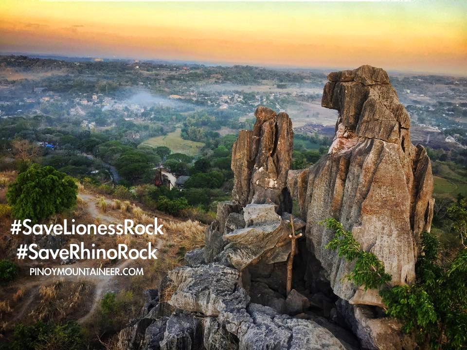
View from Mt, Isarog's summit, where Fedor Jagor said he camped in 1859
annotated by Gideon Lasco

In the course of my historical research I have stumbled upon various accounts of mountain climbing trips in the journals of hikes in the Philippines - or at least descriptions of various mountains. They are too interesting to ignore so I thought it would be nice to start a series about them. 
Fedor Jagor (1816-1900)

The first on our list is Fedor Jagor (1816–1900), a German scientist and explorer who traveled in the Philippines from 1859-1860. This account is probably the first to describe hikes up Bicol mountains. It also references the first ascent of Mayon -- apparently by two men from Scotland. I like the way these chroniclers of bygone years are so detailed with their notes. There is also some personal touch too, when he said: "I sprained my foot so badly in ascending Mayon that I was obliged to keep the house for a month."

MT. ISAROG
The Isaróg (pronounced Issaró) rises up in the middle of Camarines, between San Miguel and Lagonoy bays. While its eastern slope almost reaches the sea, it is separated on its western side by a broad strip of inundated land from San Miguel Bay. In circumference it is at least twelve leagues; and its height 1,966 meters.1 Very flat at its base, it swells gradually to 16°, and higher [191]up to 21° of inclination, and extends itself, in its western aspect, into a flat dome-shaped summit. But, if viewed from the eastern side, it has the appearance of a circular chain of mountains rent asunder by a great ravine. On Coello’s map this ravine is erroneously laid down as extending from south to north; its bearing really is west to east. Right in front of its opening, and half a league south from Goa, lies the pretty little village of Rungus, by which it is known. The exterior sides of the mountain and the fragments of its large crater are covered with impenetrable wood. Respecting its volcanic eruptions tradition says nothing.

This hillock, as well as the others which I examined, consisted of the débris of the Isaróg, the more or less decomposed trachytic fragments of hornblende rock, the spaces between which were filled up with red sand. The number of streams sent down by the Isaróg, into San Miguel and Lagonoy bays, is extraordinarily large. On the tract behind Maguiring I counted, in three-quarters of an hour, five considerable estuaries, that is to say, above twenty feet broad; and then, as far as Goa, twenty-six more; altogether, thirty-one: but there are more, as I did not include the smallest; and yet the distance between Maguiring and Goa, in a straight line, does not exceed three miles. This accounts for the enormous quantity of steam with which this mighty condenser is fed. I have not met with this phenomenon on any other mountain in so striking a manner. One very remarkable circumstance is the rapidity with which the brimming rivulets pass in the estuaries, enabling them to carry the trading vessels, sometimes even ships, into a main stream (if the expression may be allowed), while the scanty contributions of their kindred streams on the northern side have scarcely acquired the importance of a mill-brook. These waters, from their breadth, look like little rivers, although in reality they consist of only a brook, up to the foot of the mountain, and of a river’s mouth in the plain; the intermediate part being absent.

The country here is strikingly similar to the remarkable mountain district of the Gelungúng, described by yet the origin of these rising grounds differs in some degree from that of those in Java. The latter were due to the eruption of 1822, and the great fissure in the wall of the crater of the Gelungúng, which is turned towards them, shows unmistakably whence the materials for their formation were derived; but the great chasm of the Isaróg opens towards the east, and therefore has no relation to the numberless hillocks on the north-west of the mountain. Behind Maguiring they run more closely together, their summits are flatter, and their sides steeper; and they pass gradually into a gently inclined slope, rent into innumerable clefts, in the hollows of which as many brooks are actively employed in converting the angular outlines of the little islands into these rounded hillocks. The third river behind Maguiring is larger than those preceding it; on the sixth lies the large Visita of Borobod; and on the tenth, that of Ragay. The rice fields cease with the hill country, and on the slope, which is well drained by deep channels, only wild cane and a few groups of trees grow. Passing by many villages, whose huts were so isolated and concealed that they might remain unobserved, we arrived at five o’clock at Tagunton; from which a road, practicable for carabao carts, and used for the transport of the abacá grown in the district, leads to Goa; and here, detained by sickness, I hired a little house, in which I lay for nearly four weeks, no other remedies offering themselves to me but hunger and repose.

During this time I made the acquaintance of some newly-converted Igorots, and won their confidence. Without them I would have had great difficulty in ascending the mountains as well as to visit their tribe in its farms without any danger. When, at last, I was able to quit Goa, my friends conducted me, as the first step, to their settlement; where, having been previously recommended and expected, I easily obtained the requisite number of attendants to take into their charge the animals and plants which were collected for me.

On the following morning the ascent was commenced. Even before we arrived at the first rancho, I was convinced of the good report that had preceded me. The master of the house came towards us and conducted us by a narrow path to his hut, after having removed the foot-lances, which projected obliquely out of the ground, but were dexterously concealed by brushwood and leaves. A woman employed in weaving, at my desire, continued her occupation. The loom was of the simplest kind. The upper end, the chain-beam, which consists of a piece of bamboo, is fixed to two bars or posts; and the weaver sits on the ground, and to the two notched ends of a small lath, which supplies the place of the weaving beam, hooks on a wooden bow, in the arch of which the back of the lath is fitted. Placing her feet against two pegs in the ground and bending her back, she, by means of the bow, stretches the material out straight. A netting-needle, longer than the breadth of the web, serves instead of the weaver’s shuttle, but it can be pushed through only by considerable friction, and not always without breaking the chains of threads. A lath of hard wood (caryota), sharpened like a knife, represents the trestle, and after every stroke it is placed upon the edge; after which the comb is pushed forward, a thread put through, and struck fast, and so forth. The web consisted of threads of the abacá, which were not spun, but tied one to another.

The huts I visited deserve no special description. Composed of bamboos and palm-leaves, they are not essentially different from the dwellings of poor Filipinos; and in their neighborhood were small fields planted with batata, maize, caladium and sugar-cane, and enclosed by magnificent polypody ferns. One of the highest of these, which I caused to be felled for the purpose, measured in the stem nine meters, thirty centimeters; in the crown, two meters, twelve centimeters; and its total length was eleven meters, forty-two centimeters or over thirty-six feet.

A young lad produced music on a kind of lute, called baringbau; consisting of the dry shaft of the scitamina stretched in the form of a bow by means of a thin tendril instead of gut. Half a coco shell is fixed in the middle of the bow, which, when playing, is placed against the abdomen, and serves as a sounding board; and the string when struck with a short wand, gave out a pleasing humming sound, realizing the idea of the harp and plectrum in their simplest forms. Others accompanied the musician on Jews’ harps of bamboos, as accurate as those of the Mintras on the Malay Peninsula; and there was one who played on a guitar, which he had himself made, but after a European pattern. The hut contained no utensils besides bows, arrows, and a cooking pot. The possessor of clothes bore them on his person. I found the women as decently clad as the Filipino Christian women, and carrying, besides, a forest knife, or bolo. As a mark of entire confidence, I was taken into the tobacco fields, which were well concealed and protected by foot-lances; and they appeared to be carefully looked after.

In the afternoon we reached a vast ravine, called “Basira,” 973 meters above Uacloy, and about 1,134 meters above the sea, extending from south-east to north-west between lofty, precipitous ranges, covered with wood. Its base, which has an inclination of 33°, consists of a naked bed of rock, and, after every violent rainfall, gives issue to a torrent of water, which discharges itself violently. Here we bivouacked; and the Igorots, in a very short time, built a hut, and remained on the watch outside. At daybreak the thermometer stood at 13.9°

The road to the summit was very difficult on account of the slippery clay earth and the tough network of plants; but the last five hundred feet were unexpectedly easy, the very steep summit being covered with a very thick growth of thinly leaved, knotted, mossy thibaudia, rhododendra, and other dwarf woods, whose innumerable tough branches, running at a very small height along the ground and parallel to it, form a compact and secure lattice-work, by which one mounted upwards as on a slightly inclined ladder. The point which we reached was evidently the highest spur of the horseshoe-shaped mountain side, which bounds the great ravine of Rungus on the north. The top was hardly fifty paces in diameter, and so thickly covered with trees that I have never seen its like; we had not room to stand. My active hosts, however, went at once to work, though the task of cutting a path through the wood involved severe labor, and, chopping off the branches, built therewith, on the tops of the lopped trees, an observatory, from which I should have had a wide panoramic view, and an opportunity for taking celestial altitudes, had not everything been enveloped in a thick mist. The neighboring volcanoes were visible only in glimpses, as well as San Miguel Bay and some lakes in the interior. Immediately after sunset the thermometer registered 12.5°.

On the following morning it was still overcast; and when, about ten o’clock, the clouds became thicker, we set out on our return. It was my intention to have passed the night in a rancho, in order next day to visit a solfatara which was said to be a day’s journey further; but my companions were so exhausted by fatigue that they asked for at least a few hours’ rest.

On the upper slope I observed no palms with the exception of calamus; but polypodies (ferns) were very frequent, and orchids surprisingly abundant. In one place all the trees were hung, at a convenient height, with flowering aërids; of which one could have collected [205]thousands without any trouble. The most beautiful plant was a Medinella, of so delicate a texture that it was impossible to preserve it.

Within a quarter of an hour north-east of Uacloy, a considerable spring of carbonic acid bursts from the ground, depositing abundance of calcareous sinter. Our torches were quickly extinguished, and a fowl covered with a cigar-box died in a few minutes, to the supreme astonishment of the Igorots, to whom these phenomena were entirely new.

Farewell to mountaineers. On the second day of rest, my poor hosts, who had accompanied me back to Uacloy, still felt so weary that they were not fit for any undertaking. With naked heads and bellies they squatted in the burning sun in order to replenish their bodies with the heat which they had lost during the bivouac on the summit; for they are not allowed to drink wine. When I finally left them on the following day, we had become such good friends that I was compelled to accept a tamed wild pig as a present. A troop of men and women accompanied me until they saw the glittering roofs of Maguiring, when, after the exchange of hearty farewells, they returned to their forests.

From barometrical observations—

Goa, on the northern slope of the Isaróg32
Uacloy, a settlement of Igorots161
Ravine of Baira1,134
Summit of the Isarog1,966

Blogger's note: Given his description of the summit being 1966 MASL, he must reached the exact peak that we now reach after going up the Panicuason Trail. Like any mountaineer today, he must have been disappointed with the lack of learning at the top! 

Reference: The Former Philippines Through Foreign Eyes (Craig, 1917 ed.). Available: http://www.gutenberg.org/files/10770/10770-h/10770-h.htm#xd20e3939

FEDOR JAGOR'S HIKES IN BICOL (1859-1860)
Hiking in Philippine history #1: Mt. Isarog
Hiking in Philippine history #2: Mt. Asog
Hiking in Philippine history #3: Mt. Masaraga
Hiking in Philippine history #4: Mt. Mayon

Hikes in Philippine History #2: German explorer Fedor Jagor dayhikes Mt. Asog in 1859

$
0
0
The view from Mt. Asog - which Fedor Jagor would have seen if the
summit weren't covered with clouds
annotated by Gideon Lasco

In the course of my historical research I have stumbled upon various accounts of mountain climbing trips in the journals of hikes in the Philippines - or at least descriptions of various mountains. They are too interesting to ignore so I thought it would be nice to start a series about them. 
Fedor Jagor (1816-1900)

The first featured hiker on our list is Fedor Jagor (1816–1900), a German scientist and explorer who traveled in the Philippines from 1859-1860. This account, originally in German and later translated in English, is probably the first to describe hikes up Bicol mountains. After Mt. Isarog (Hikes in Philippine History #1), we continue with his account about Mt. Asog, which he referred to with its alternate name, Mt. Iriga.

MT. IRIGA (ASOG)
From the Isarog I returned through Naga and Nabua to Iriga, the ascent of which I at length accomplished.

The ascent.The chief of the Montesinos had received daily rations for twenty-two men, with whom he professed to make a road to the summit; but when, on the evening of the third day, he came himself to Iriga, in order to fetch more provisions, on the pretext that the work still required some time for execution, I explained that I should endeavor to ascend the mountain on the following morning, and requested him to act as guide. He consented, but disappeared, together with his companions, during the night; the Filipinos in the tribunal having been good enough to hold out the prospect of severe punishment in case the work performed should not correspond to the working days.

After fruitless search for another guide, we left Buhi in the afternoon, and passed the night in the rancho, where we had previously been so hospitably received. The fires were still burning, but the inhabitants, on our approach, had fled. About six o’clock on the following morning the ascent began. After we had gone through the forest, by availing ourselves of the path which we had previously
beaten, it led us through grass three or four feet in height, with keen-edged leaves; succeeded by cane, from seven to eight feet high, of the same habitat with our Arundo phragmites (but it was not in flower), which occupied the whole of the upper part of the mountain as far as the edge. Only in the ravine did the trees attain any height. The lower declivities were covered with aroids and ferns; towards the summit were tendrils and mosses; and here I found a beautiful, new, and peculiarly shaped orchid.

The Cimarrons had cut down some cane; and, beating down our road for ourselves with bolos, we arrived at the summit a little before ten o’clock. It was very foggy. In the hope of a clear evening or morning I caused a hut to be erected, for which purpose the cane was well fitted. The natives were too lazy to erect a lodging for themselves, or to procure wood for a watchfire. They squatted on the ground, squeezed close to one another to warm themselves, ate cold rice, and suffered thirst because none of them would fetch water. Of the two water-carriers whom I had taken with me, one had “inadvertently” upset his water on the road, and the other had thrown it away “because he thought we should not require it.”

Altitude.I found the highest points of the Iriga to be 1,212 meters, 1,120 meters above the surface of the Buhi Lake. From Buhi I went to Batu.

The Batu Lake (one hundred eleven meters above the sea) had sunk lower since my last visit in February. The carpet of algae had increased considerably in breadth, its upper edge being in many places decomposed; and the lower passed gradually into a thick consistency of putrid water-plants (charae, algae, pontederiae, valisneriae, pistiae, etc.), which encompassed the surface of the water so that only through a few gaps could one reach the bank.

Right across the mouth of the Quinali lies, in the lake, a bar of black mud, the softest parts of which were indicated by some insignificant channels of water. As we could not get over the bar in a large boat, two small skiffs were bound together with a matting of bamboo, and provided with an awning. By means of this contrivance, which was drawn by three strong carabaos (the whole body of men with evident delight and loud mirth wading knee-deep in the black mud and assisting by pushing behind) we succeeded, as if on a sledge, in getting over the obstacle into the river; which on my first visit overflowed the fields in many places, till the huts of the natives rose out of the water like so many ships: but now (in June) not one of its channels was full. We were obliged in consequence to continue our sledge journey until we were near to Quinali.

Blogger's note: Again, Fedor Jagor failed to see a clearing at the summit of Mt. Asog -- too bad for him! But it seems that he has a relatively fast pace as it only took him four hours to reach the summit from the trailhead. Yes, dayhikes were already in done in the 19th century!

Reference: The Former Philippines Through Foreign Eyes (Craig, 1917 ed.). Available: http://www.gutenberg.org/files/10770/10770-h/10770-h.htm#xd20e3939

FEDOR JAGOR'S HIKES IN BICOL (1859-1860)
Hiking in Philippine history #1: Mt. Isarog
Hiking in Philippine history #2: Mt. Asog
Hiking in Philippine history #3: Mt. Masaraga
Hiking in Philippine history #4: Mt. Mayon

Hikes in Philippine History #3: German explorer Fedor Jagor hikes up Mt. Masaraga in 1859

$
0
0
Mt. Masaraga was the third mountain that Fedor Jagor hiked in Bicol,
way back in 1859!
annotated by Gideon Lasco

In the course of my historical research I have stumbled upon various accounts of mountain climbing trips in the journals of hikes in the Philippines - or at least descriptions of various mountains. They are too interesting to ignore so I thought it would be nice to start a series about them. 
Fedor Jagor (1816-1900)

The first featured hiker on our list is Fedor Jagor (1816–1900), a German scientist and explorer who traveled in the Philippines from 1859-1860. This account, originally in German and later translated in English, is probably the first to describe hikes up Bicol mountains. After Mt. Isarog (Hikes in Philippine History #1) and Mt. Asog (HPH #2), we continue with his account with an overnight hike up Mt. Masaraga. 

MT. MASARAGA
At Ligao I alighted at a friendly Spaniard’s, a great part of the place, together with the tribunal and convent, having been burnt down since my last visit. After making the necessary preparations, I went in the evening to Barayong, a little rancho of Cimarrons at the foot of the Mazaraga, and, together with its inhabitants, ascended the mountain on the following morning.

The women also accompanied us for some distance, and kept the company in good humor; and when, on the road, a Filipino who had been engaged for the purpose wished to give up carrying a bamboo full of water, and, throwing it away, ran off, an old woman stepped forward in his stead, and dragged the water cheerfully along up to the summit.

This mountain was moister than any I had ever ascended, the Semeru in Java, in some respects, excepted; and half-way up I found some rotten rafflesia.

Two miserable-looking Cimarron dogs drove a young stag towards us, which was slain by one of the people with a blow of his bolo. The path ceased a third of the way up, but it was not difficult to get through the wood. The upper portion of the mountain, however, being thickly overgrown with cane, again presented great obstacles.

About twelve we reached the summit-level, which, pierced by no crater, is almost horizontal, smoothly arched, and thickly covered with cane. Altitude.Its height is 1,354 meters. In a short time the indefatigable Cimarrons had built a fine large hut of cane: one room for myself and the baggage, a large assembly-room for the people, and a special apartment for cooking.

Unfortunately the cane was so wet that it would not burn. In order to procure firewood to cook the rice, thick branches were got out of the wood, and their comparatively dry pith extracted with great labor. The lucifer-matches, too, were so damp that the phosphorus was rubbed away in friction; but, being collected on blotting-paper, and kneaded together with the sulphurous end of the match-wood, it became dry and was kindled by friction. Not a trace of solid rock was to be seen. All was obstructed by a thick overgrowth from where the path ceased, and the ground covered with a dense bed of damp wood-earth.

The following morning was fine, and showed a wide panorama; but, before I had completed my drawing, it again became misty; and as, after several hours of waiting, the heavens were overspread with thick rain-clouds, we set out on our return.

Numerous butterflies swarmed around the summit. We could, however, catch only a few, as the passage over the cane-stubble was too difficult for naked feet; and, the badly-stitched soles of two pairs of new shoes which I had brought from Manila having dropped off some time before I reached the summit, I was compelled to perform the journey to Ligao barefoot.

Blogger's note: I love this account! Over 150 years after he climbed Masaraga, I can still relate to his cogon-filled ascent (he calls it cane). You've got to admire the intrepid spirit of this man. And to think that his shoe broke on the way down! My own Mt. Masaraga hike is narrated at Hiking matters #162.

Reference: The Former Philippines Through Foreign Eyes (Craig, 1917 ed.). Available: http://www.gutenberg.org/files/10770/10770-h/10770-h.htm#xd20e3939

FEDOR JAGOR'S HIKES IN BICOL (1859-1860)
Hiking in Philippine history #1: Mt. Isarog
Hiking in Philippine history #2: Mt. Asog
Hiking in Philippine history #3: Mt. Masaraga
Hiking in Philippine history #4: Mt. Mayon

Hikes in Philippine History #4: German explorer Fedor Jagor's finale in Bicol: Mt. Mayon in 1859

$
0
0
Mason Volcano, the finale of the four mountains in Bicol that
German explorer Fedor Jagor hiked in 18
annotated by Gideon Lasco

In the course of my historical research I have stumbled upon various accounts of mountain climbing trips in the journals of hikes in the Philippines - or at least descriptions of various mountains. They are too interesting to ignore so I thought it would be nice to start a series about them. 
Fedor Jagor (1816-1900)

The first featured hiker on our list is Fedor Jagor (1816–1900), a German scientist and explorer who traveled in the Philippines from 1859-1860. This account, originally in German and later translated in English, is probably the first to describe hikes up Bicol mountains. After three mountains (Isarog, Asog, Masaraga), this is his finale: no less than beautiful Mayon Volcano!

MT. MAYON
My Spanish friends enabled me to rent a house in Daraga,1 a well-to-do town of twenty thousand inhabitants at the foot of the Mayon, a league and a half from Legaspi. The summit of this volcano was considered inaccessible until two young Scotchmen, Paton and Stewart by name, demonstrated the contrary. Since then several natives have ascended the mountain, but no Europeans.

I set out on September 25th, and passed the night, by the advice of Señor Muños, in a hut one thousand feet above the level of the sea, in order to begin the ascent the next morning with unimpaired vigor. But a number of idlers who insisted on following me, and who kept up a tremendous noise all night, frustrated the purpose of this friendly advice; and I started about five in the morning but little refreshed.

The fiery glow I had noticed about the crater disappeared with the dawn. The first few hundred feet of the ascent were covered with a tall grass quite six feet high; and then came a slope of a thousand feet or so of short grass succeeded by a quantity of moss; but even this soon disappeared, and the whole of the upper part of the mountain proved entirely barren.

We reached the summit about one o’clock. It was covered with fissures which gave out sulphurous gases and steam in such profusion that we were obliged to stop our mouths and nostrils with our handkerchiefs to prevent ourselves from being suffocated. We came to a halt at the edge of a broad and deep chasm, from which issued a particularly dense vapor. Apparently we were on the brink of a crater, but the thick fumes of the disagreeable vapor made it impossible for us to guess at the breadth of the fissure.

The absolute top of the volcano consisted of a ridge, nearly ten feet thick, of solid masses of stone covered with a crust of lava bleached by the action of the escaping gas. Several irregular blocks of stone lying about us showed that the peak had once been a little higher. When, now and again, the gusts of wind made rifts in the vapor, we perceived on the northern corner of the plateau several rocky columns at least a hundred feet high, which had hitherto withstood both storm and eruption. I afterwards had an opportunity of observing the summit from Daraga with a capital telescope on a very clear day, when I noticed that the northern side of the crater was considerably higher than its southern edge.

Our descent took some time. We had still two-thirds of it beneath us when night overtook us. In the hope of reaching the hut where we had left our provisions, we wandered about till eleven o’clock, hungry and weary, and at last were obliged to wait for daylight. This misfortune was owing not to our want of proper precaution, but to the unreliability of the carriers. Two of them, whom we had taken with us to carry water and refreshments, had disappeared at the very first; and a third, “a very trustworthy man,” whom we had left to take care of our things at the hut, and who had been ordered to meet us at dusk with torches, had bolted, as I afterwards discovered, back to Daraga before noon.

My servant, too, who was carrying a woolen blanket and an umbrella for me, suddenly vanished in the darkness as soon as it began to rain, and though I repeatedly called him, never turned up again till the next morning. We passed the wet night upon the bare rocks, where, as our very thin clothes were perfectly wet through, we chilled till our teeth chattered. As soon, however, as the sun [88]rose we got so warm that we soon recovered our tempers. Towards nine o’clock we reached the hut and got something to eat after twenty-nine hours’ fast.

***

I learnt from Mr. Paton that the undertaking had also been represented as impracticable in Albay. “Not a single Spaniard, not a single native had ever succeeded in reaching the summit; in spite of all their precautions they would certainly be swallowed up in the sand.” However, one morning, about five o’clock, they set off, and soon reached the foot of the cone of the crater. Accompanied by a couple of natives, who soon left them, they began to make the ascent. Resting half way up, they noticed frequent masses of shining lava, thrown from the mouth of the crater, gliding down the mountain. With the greatest exertions they succeeded, between two and three o’clock, in reaching the summit, where, however, they were prevented by the noxious gas from remaining more than two or three minutes. During their descent, they restored their strength with some refreshments Sr. Muñoz had sent to meet them; and they reached Albay towards evening, where during their short stay they were treated as heroes, and presented with an official certificate of their achievement, for which they had the pleasure of paying several dollars.

Blogger's note: In this dayhike-turned-overnight hike, Jagor describes Mayon very similarly to how a hike of it will look like today. He had a hard time. Later in his diary he would write: "I sprained my foot so badly in ascending Mayon that I was obliged to keep the house for a month."

Blogger's note: Given his description of the summit being 1966 MASL, he must reached the exact peak that we now reach after going up the Panicuason Trail. Like any mountaineer today, he must have been disappointed with the lack of learning at the top! 

Reference: The Former Philippines Through Foreign Eyes (Craig, 1917 ed.). Available: http://www.gutenberg.org/files/10770/10770-h/10770-h.htm#xd20e3939

FEDOR JAGOR'S HIKES IN BICOL (1859-1860)
Hiking in Philippine history #1: Mt. Isarog
Hiking in Philippine history #2: Mt. Asog
Hiking in Philippine history #3: Mt. Masaraga
Hiking in Philippine history #4: Mt. Mayon

Guiding Document: 2nd National Mountain Clean-up Day on May 9, 2015

$
0
0
STATEMENT OF PURPOSE
Inspired by the first National Mountain Clean-up Day in 2014, the second NMCD is envisioned to live up to being an annual reminder to the public of the importance of having clean mountains, as well as a set of simultaneous activities organised by different groups that will clean up mountains and other natural areas in different parts of the Philippines.

Note: In 2016, the whole month of May is to be designated as "Mountain Clean-up Month" and the NMCD, which is the first Saturday of the month, will be the culmination of the commemoration. In this, we follow the original rationale of holding the NMCD after the peak season of hiking activities (i.e. Holy Week and the summer months) and before the rainy season.

SCHEDULE AND VENUE
The second NMCD is scheduled to be first held on May 9, 2015. The venues are are the mountains and areas with hiking activity that are both within and outside the designated Protected Areas by the government.

ORGANIZATION 

1. At the national level, the lead proponent/s of the project will be coordinating the initiative in partnership with the Department of Environmental and Natural Resources through its relevant agencies. The local events however will be organised by different groups.

2. The organisers of each of the clean-up climbs will be assembled in one Internet group through a suitable social media platform in order to disseminate information. For climb organizers, please click this link to access the Facebook group for the NMCD.

3. There will be a designated coordinator for each clean-up climb who will be responsible for the participants and the conduct of the hike and the clean up. All coordinators must have basic mountaineering skills and must have experience in organising hikes.

PARTICIPATION 

1. Any hiking or outdoor club, civic organization, or group of individuals may join the NMCD. Groups are at liberty to select their target mountain for clean-up. However, there may not be several groups doing a clean-up in a single trail or area.

2. Participating groups are responsible for the safety and well-being of their participants.

3. Every group must have a designated coordinator.

4. The coordinator for each climb must make sure that his participants are sufficiently fit to participate in the activity, have sufficient mountaineering skills and experience, knows what to do in case of emergency, and is aware of the Leave No Trace principles. If a participant is below 18 years of age, parental consent must be secured.

5. The maximum number of participants per group is 18. However, this is just a general guideline. The policies set by the mountain authorities (i.e. PASU, ENRO, barangay officials) take precedence over this guideline.

6. The organising party will coordinate with the Protected Area Management Board through the Park Superintendent. If the mountain is not a protected area, the organising party should instead coordinate with the local government unit in charge of the mountain. The following should be endorsed and consulted:
a. The number, names, and contact information of participants
b. The itinerary of the hike
c. Areas that will be cleaned up
d. Emergency plan
e. Waste disposal plan

7. In case there are several groups seeking to hold clean-up activities, the Park Superintendent will determine the maximum number of participants for each group, as well as how the groups will be divided according to target areas of clean-up. In mountains not falling under protected areas, should designate a lead coordinator for the clean-up efforts for the particular mountain, and discuss beforehand to designate particular areas to be cleaned by each group.

8. In protected areas, the Park Superintendent will designate the designated waste disposal facility. For other areas, the DENR will provide advice at the national level while the participating groups will also coordinate with the relevant LGU on where the garbage will be disposed.

9. All participants must treat every clean-up climb as a regular hike and thus they must have contingency plans, designation of tasks (i.e. lead, sweeper, medic). Importantly, every team should have a first aider who can respond to injuries like cuts that may be caused by picking up garbage.

10. Participating groups should feel free to organise other activities concurrently with the clean-up, including, but not limited to community outreach, dialogues and lectures about Leave No Trace principles, among others.

GARBAGE COLLECTION AND DISPOSAL

1. For the purposes of the event, garbage is defined as any material that was brought by humans to the mountains and does not serve any useful purpose. Common garbage in the mountains include various kinds of plastics, glass bottles, cans, any form or piece of paper, cloth, or any other material left by humans. All forms of garbage should be collected from the campsites, trails, peaks, and other areas of interest.

2. Participants will be advised to use garbage bags to collect the trash. Each participant should try to fill one or two garbage bags depending on the number of trash on the trail. The bags must be of sufficient thickness to withstand being transported through the trail. If in doubt, consider using two bags for double thickness. Biodegradable, environment-friendly garbage bags are preferred.

3. Participants should wear rubber gloves or equivalent for sanitary reasons, as well as to protect themselves from possible cuts or injuries from sharp trash like bottles. Special precaution should be exercised when handling glass shards as well as opened tin cans, as their edges can cause injuries.

4. Participating teams should consider bringing other tools such as a hand trowel that can assist in retrieving buried cans, glass, and other forms of garbage.

5. The sweeper, or the last person in the group, must ensure that no trash bags are left behind, and that they are not left in huts, rest stops, not even in the trailhead, regardless of the existence of trash cans there. Only the designated waste disposal area should be considered. If necessary, groups should transport the garbage with them to a point where proper waste disposal is assured.

6. At the designated waste disposal facility, the groups should measure the weight (i.e. in kilos) and volume (in number of bags) of the garbage they were able to collect. In the absence of a designated waste dis

7. In cases where locals would demand that participants leave the garbage in certain places, like campsites, participating groups are encouraged to abide with the chain of waste disposal as long as this can be done amicably.

FEEDBACK
In order to improve on future clean-up days and also to guide future clean-up activities, participating groups will be requested to report the following to the PASUs or, if outside a protected area, to the coordinators for compilation:

a. Actual number of participants
b. Areas where garbage was found
c. Weight and volume of garbage collected
d. Problems and challenges encountered
e. Personal/group reflections on the activity
f. Recommendations for the next NMCD
g. Status of the mountain
h. Photos of the mountain 

List of groups joining the National Mountain Clean-up Day on May 9, 2015

$
0
0
PARTIAL LIST OF CLEAN-UP CLIMBS FOR THE NMCD 2015
As of April 29, 2015

DESTINATION
ORGANIZING CLUB OR GROUP
CONTACT PERSON
CONTACT #
Mt. Arayat
Loyola Mountaineers
Charles Pe
Mt. Lantoy (Argao, Cebu)
Kalain Trekkers
Alitzur Clint Villones Rustila
09163424851
Mt. Makiling
Jepoi Mansibang

Kayo Mountaineers
Migs Siena
09475126854
Mt. Kanlaon
UgyonKatreebu La Castellana Mountaineering
Kristine Fria

Freelance hikers of Cebu
Jessie Lee Ubay
09985364202
Manabu Peak
Team360
Christopher Lorden Z. Patingo
09088100892
Dahong Palay Mountaineers
Ernie Fines
09299735756
Balakayu Mountains, South Cotabato
Joseph Sanchez
09079622418 
Mt. Sto Tomas
Discover Islam Baguio 
Bedejim Abdullah 
09065174913 
Mt. Isarog
Hagahag Mountaineering Club
Ted Arel
09216427451 
Mt. Talinis
Alimatok Mountaineer
Adrian Cabrera Pajunar
Mt. Binacayan and Pamitinan
Montalban Mountaineering Club
 Rupert Sallave-Ecot Yaun
09278550180 
Mt. Daraitan
Lakbay Group
Joseph Sanchez
09079622418 
Mt. Batulao
LCMS
John Arce
09173060482 

HOW TO JOIN 
Review the Guiding Document for details. You can add your group by commenting on this page with the following details:

Mountain to be cleaned-up, and trail to be used:
Group (does not have to be a formal organisation):
Contact person:
Contact information:

Important: It is the responsibility of every group to ensure the fitness and preparedness of their participants, to coordinate with the relevant LGU / local officials, and to ensure proper waste disposal.

FREQUENTLY-ASKED QUESTIONS

1. I do not have a group. How can I join the clean-up climbs?
The contact numbers of the organizers are listed in the table above. You can contact them to signify your interest. However, please understand that because not everyone can be at the same mountains at the same time, not everyone can join the initiative. However, everyone is encouraged to organise and join clean ups and other environment-supporting activities throughout the year.

2. Our group has signed up but we do not know how to organize a clean-up climb. How do we go about it?
Organizing a clean-up climb is not rocket science. Basically a clean-up climb is just the act of climbing a mountain to collect trash in the trails, campsites, and points of interest and bringing it down to a place where proper waste disposal is practiced. Please refer to the Guiding Document for additional guidance.

3. What if there are several groups doing a clean-up climb in one mountain?
The reason why I am posting the groups who have already announced their intentions is so that we can avoid such a situation. Groups who have decided on the same destination can discuss among themselves how to work it out. For examples, many mountains have different trails and groups can focus their clean-up efforts in a particular trail. Two or three groups doing a clean-up for one mountain is not a bad especially if these mountains are high-impact to begin with, and have many trash to be collected. The important thing is that groups cooperate with each other and with the local government.

4. How much will participating in the clean-up climbs cost?
It will cost nothing. There will be no registration or other fees. Of course, you will have expenses like going to the mountain, or contributing to the food, transpo, etc, for your own climbs. PinoyMountaineer itself is not the organizer of one big event, but the coordinator of many small events happening at the same time. I want this event to be as 'grassroots' as possible but providing the necessary unity to it.

5. Why do you have to do a cleanup day? Cleaning up the mountains should be done year round!
To this kind of argument, I might as well respond: "Why do you have to celebrate your mother's birthday? Celebrating her should be done year round!" Definitely, making our climbs clean and holding clean-up climbs should be practiced throughout the year. But we need special days to remind us - and to send a message to  others - that mountains should be kept clean, and it is a shared responsibility.

6. Where will Pinoy Mountaineer be during the clean-up day?
I will be doing a clean-up outside of the country - which is part of the reason why I was initially hesitant to schedule the Clean-up Day in May. But I will be coordinating the event with the help of the newly-formed PM Environmental Committee led by Carlo Cunanan. They will also be organising a clean-up.

7. Will there be IDs and event/souvenir shirts?
I know that shirts and IDs are important for hiking events. However, to avoid any financial and logistical issues, any shirt that will be produced as an event shirt will be open source design which groups and individuals can just download and print for themselves and add their logos on it. This logo is now available on PM Facebook page and the Group Page for the NMCD.


Hiking matters #455: Hiking in Castlewood State Park, St. Louis, Missouri

$
0
0
Hiking in Castlewood State Park, Missouri
with a view of the Meramec River
ST. LOUIS, MISSOURI - I wasn't expecting to have a second hike here in St. Louis but thanks again to my colleague Carolyn Powers, it happened - and on a perfect spring day at that! The destination was Castlewood State Park, which offers great views of the Meramec River. Joining us was Carolyn's dog Kenshin, who proved to be a great companion!

After a quick drive from St. Louis, we went for the 3-mile River Scene Trail. It was immediately forested, and we were surrounded with deciduous trees with freshly-sprouted leaves. It reminded me of some of the mahogany forests we have in the Philippines. Though the highest point in the trail was a mere 124 meters, there were enough ups and downs to make it enjoyable.

Soon we reached the bluffs, and though the view of the river was at first disappointing, it became more and more beautiful as we went further. Aside from the splendid trees - white oak, northern red oak and shagbark hickory - the lush valley was a refreshing sight, animated by different kinds of birds.
It was a Friday but we encountered a lot of people on the trail - which testifies to its place as one of the best hiking spots near St. Louis. Even so there was plenty of lookout spots for everyone. As for the hike itself, I was very easy - and the section along the bluffs was particularly memorable.
Soon we were by the banks of the Meramec, which signaled the end of the hike. Buford Mountain (see Hiking matters #454) was more substantial, but Castlewood was much more scenic, and I'm really very happy to have done it before I leave St. Louis!


SPRING HIKES IN THE US (2015)
Hiking matters #453: Camelback Mountain, Phoenix, AZ
Hiking matters #454: Buford Mountain, Missouri
Hiking matters #455: Castlewood State Park, St. Louis, MO

Hiking matters #454: A loop hike of Buford Mountain in Missouri

$
0
0
ST. LOUIS, MISSOURI - I had feared that I would a hike-less month in the course of my scholarly visit here in the US - it would have been the first time since 2010 that I'd had a month without hiking!  Thankfully, my colleague Carolyn Powers - who loves the outdoors as much as I do - rescued me from my usual Forest Park walks and we hiked Buford Mountain.
Buford Mountain, a nearly two-hour drive from St. Louis, is part of the famous Ozark Mountains, and  although just over 500 MASL, it is one of the highest mountains in Missouri! Moreover, the trail itself is a good 10.5 miles - which makes for a worthy dayhike.
We started trekking at around 0900H. The weather was forecast to be cloudy but there was actually a light drizzle in the first part of our hike. Fortunately the ground was not muddy and it was a straightforward trek through the forest of oak and hickory, until we reached the ridgeline.

The ridgeline features five peaks, each with a glade. There were ups-and-downs of 100 feet or so, but all very relaxing. The highlight was Bald Knob, which does have a knob-like rock where one could stand and enjoy a view of the Arcadian and Belleview Valleys.

From Bald Knob, we made a descent, and this is we started to see all kinds of wildlife - a turtle, two snakes, a nice lizard, and a tiny frog! Not to mention all the birds Carolyn identified. It was a delight to see al those animals, and the weather also turned for the better; it was sunny by the time we had looped back to the ridge.
By1500H we were back the trailhead, satisfied with the day's adventure. As a bonus, we managed to swing by the Lone Elk County Park in St. Louis, where we saw some buffalo. Altogether, it was a great time in the outdoors! Thank you Carolyn Powers for making it possible!


SPRING HIKES IN THE US (2015)
Hiking matters #453: Camelback Mountain, Phoenix, AZ
Hiking matters #454: Buford Mountain, Missouri
Hiking matters #455: Castlewood State Park, St. Louis, MO

Hiking matters #453: A traverse of Camelback Mountain in Phoenix, Arizona

$
0
0
Hiking up the "Praying Monk" section of Camelback Mountain
in Phoenix, Arizona
ST. LOUIS, MISSOURI - In 2012, I did some autumn hikes in Arizona, where my Uncle Larry (a longtime supporter of my adventures) lives (see Hiking matters #313). Two Stateside trips later, I am glad to have come back and sneak in one hike - that of the famous Camelback Mountain in Phoenix. This mountain is so named because "it resembles the hump and the head a kneeling camel" as one guidebook puts it. As we approached the mountain, it indeed looked the part.
Wanting to maximise the trip, I decided to do a traverse of the mountain, ascending via the Echo Canyon Trail, and descending via the Cholla Trail. As the mountain is just 825 MASL, the entire traverse could be done in half a day.
The desert is a very unique environment for hiking - it is very dry and can be, paradoxically, hot and cold at the same time - but the good thing is that the weather is almost always nice. Such was the case when I started hiking. I was enthralled by the cactus and other desert plants that many of them take for granted -- this is always the benefits of coming from another country: you get to enjoy the scenery more.

Because so many people do it - from individual trail runners to families and groups of casual walkers and even tourists - the Echo Canyon Trail is sometimes rated as "very difficult" or "almost like rock climbing" but it is actually just an easy hike with some scrambling. Ever efficient, the park authorities even put metal railings on the moderately steep parts so as to minimise accidents in what is called the "Praying Monk" section.

It did not take long for me to reach the summit, which offered panoramic views of the Phoenix Metropolitan Area. From up there you can really appreciate the vastness of the desert, with the plains extending in all directions, interrupted only by occasional (and distant) clumps of highland.

The Cholla Trail was, in my opinion, more scenic than the Echo Canyon, as it passes through a ridgeline with drops on both sides. It reminded me a bit of Mt. Batulao, except that Camelback is more rocky and precipitous. Good thing my La Sportiva shoes did the trick - it was a success, and soon I was having lunch with my uncle in Phoenix! I thank him and my Tita Maricar for another warm welcome in such a beautiful part of the US!


SPRING HIKES IN THE US (2015)
Hiking matters #453: Camelback Mountain, Phoenix, AZ
Hiking matters #454: Buford Mountain, Missouri
Hiking matters #455: Castlewood State Park, St. Louis, MO

Hiking matters #456: Rucu Pichincha (4698m) in Ecuador, my first hike in the Andes

$
0
0
Pichincha, one of the prominent volcanoes of the Ecuadorian Andes
QUITO, ECUADOR - It feels great to finally reach six continents! Of course, I am aspiring for seven, but still, being in South America is significant for me. Culturally, we have much in common with many countries in this continent, as we share a similar colonial past under Spanish rule. And of course, as a hiker, there is the great Andes - the second highest mountain range in the world, next to the Himalayas.
The popular choice is to go to Macchu Picchu - or perhaps the Patagonia, but I am not in a hurry to visit those places. I just wanted a short break and decided on Ecaudor, with its countless hiking possibilities. Though not as famous as Peru or Argentina, Ecuador actually has some of highest volcanoes in the world including Chimborazo (6311 MASL) and Cotopaxi (5897m).

Moreover, the Ecuadorian capital Quito, at 2800 MASL, is a perfect place to acclimatise, while at the same time a great place to do some sightseeing (the Old Town is one of the first-ever World Heritage Sites). Today, after two days in Quito, I did my first Andes hike, Rucu Pichincha (4698m), one of the three peaks of the Volcan Pichincha.

I took a taxi from Quito ($4 one-way) to the TeleferiQo (round trip $8.50) which brought me up to the trailhead, 3945 MASL. I started trekking at 0846H. It was an easy walk along a vast expanse of grassland slopes, with great views of Quito throughout. The only challenge was the altitude - though I thankfully did not feel anything (yet), I was careful to move slowly but steadily.

At the base of the peak itself, however, the foot trail ended, and there was no way up but to go through a scree slope, then go past the "Paso del Muerte" (Pass of Death) - a narrow sliver of rock with ravines on both sides. Given the fact that the peak was surrounded with clouds, it was quite challenging going up not knowing what to expect beyond the next few meters!

Fortunately I managed to reach the summit, at 1048H. In the end, it didn't take too long -- but it certainly felt longer while I was trying to scale the summit! The phone died down after a couple of shots, but in any case I could only stay for a few minutes as it felt very cold. There was still a bit of excitement on the way down the rocks and the scree slopes, but otherwise it was a smooth return to Quito. A great start of my hiking trip here!

HIKING IN THE ECUADORIAN ANDES
Hiking matters #456: Rucu Pichincha
Hiking matters #457: Volcan Quilotoa
Hiking matters #458: Illinizas Norte
Hiking matters #459: Volcan Pasochoa

Hiking matters #457: The beautiful crater lake of Volcan Quilotoa in Ecuador

$
0
0
An alpaca (a South American mammal that resembles a small llama)
stares at the turquoise waters of Volcan Quilotoa's Crater Lake
AVENUE OF THE VOLCANOES, ECUADOR - The day after the Rucu Pichincha hike (Hiking matters #456), I joined a tour to Volcan Quilotoa which included a trek down to its crater lake. At 3914m, the volcano would be a good place to acclimatise, and it will also be a chance for me to see the Andean countryside.
From Quito we drove towards the direction of Latacunga and first stopped at a market where we saw 
llamas and got to try all sorts of fruits, and encountered the Quechua (Kwicha) people, many still wearing their colourful costumes. 
As we drove up the volcano rim, we passed by the Rio Toachi Canyons (2591m) which offer interesting scenery. These canyons are actually part of the larger Quilotoa Loop, which make for a two- or three-day hike around the volcano.
After Rio Toachi, we proceeded to the crater rim mirador (viewpoint) in Quilotoa. The view of the crater lake, with its turquoise waters, was magical! We took the wide trail down to the lake itself, seeing the lake in various vantage points, as the clouds play with its appearance.
After 30 minutes or so, we arrived at the lake and canoed for about half an hour. Then we trekked up the 300 meters back to the rim - it took longer this time around. After a nice lunch at one of the restaurants at the rim, we headed back, and I began my stay in a hacienda-turned-hotel located in the "Avenue of the Volcanoes". 

HIKING IN THE ECUADORIAN ANDES
Hiking matters #456: Rucu Pichincha (4698m)
Hiking matters #457: Volcan Quilotoa
Hiking matters #458: Illinizas Norte
Hiking matters #459: Volcan Pasochoa
Viewing all 611 articles
Browse latest View live