![]() |
Dr. Charles Pickering
(1805-1878) |
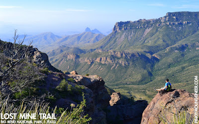
annotated by Gideon LascoFrom the "Manila and Sulu in 1842" narrative by US Com. Chas. Wilkes, U.S.N. 459, volume 5 of his "Narrative of U. S. Exploring Expedition 1838-42", we find an account of a hike up Mt. Banahaw by two members of the expedition, Dr. Charles Pickering and Lieutenant Henry Eld. Charles Pickering himself gives an account in his "The Races of Man", and I have the pleasure of presenting both their accounts here as part of our "Hikes in Philippine History" series.
Interesting here is the use of the word "Maijaijai" to refer to the volcano, and the archaic spelling of Banahaw, "Banajao". Also of interest is the fact that there is a small hut at the summit, and that there is an inhabited half-way point some three hours away from the peak. Is this the Tatlong Tangke Trail?
AN ACCOUNT BY COMMODORE WILKESAbout noon they left Don Escudero's, and took a road leading to the southward and eastward, through a luxuriant and beautiful country, well cultivated, and ornamented with lofty coconut trees, betel palms, and banana groves. Several beautiful valleys were passed, with streamlets rushing through them. Maijaijai is situated about one thousand feet above the Laguna de Bay, but the rise is so gradual that it was almost imperceptible.
The country has everywhere the appearance of being densely peopled; but no more than one village was passed between Santa Cruz and the mission. They had letters to F. Antonio Romana y Aranda, padre of the mission, who received them kindly, and entertained them most hospitably.
Climbing BanajaoWhen he was told of their intention to visit the mountain, he said it was impossible with such weather, pointing to the black clouds that then enveloped its summit; and he endeavoured to persuade the gentlemen to desist from what appeared to him a mad attempt; but finding them resolved to make the trial, he aided in making all the necessary preparations, though he had no belief in their success.
On the morning of the 27th, after mass, Mr. Eld and Dr. Pickering set out, but Mr. Sturges preferred to keep the good padre company until their return. The padre had provided them with guides, horses, twenty natives, and provisions for three days. He had been himself on the same laborious journey, some six months before, and knew its fatigues, although it turned out afterwards that his expedition was performed in fine weather, and that he had been borne on a litter by natives the whole way. The first part of the road was wet and miry, and discouraging enough. The soil was exceedingly rich, producing tropical plants in great profusion, in the midst of which were seen the neat bamboo cottages, with their industrious and cleanly-looking inhabitants. When they reached the foot of the mountain, they found it was impossible to ride farther, and were obliged to take to walking, which was, however, less of a hardship than riding the little rats of horses, covered with mud and dirt, which were at first deemed useless; but the manner in which they ascended and maintained themselves on the slippery banks, surpassed anything they had before witnessed in horseflesh.
The first part of the ascent of the mountain was gradual, but over a miry path, which was extremely slippery; and had it not been for the sticks stuck down by the party of the padre in their former ascent, they would have found it extremely difficult to overcome; to make it more disagreeable, it rained all the time. It took about two hours to reach the steep ascent. The last portion of their route had been through an uninhabited region, with some openings in the woods, affording pasture-grounds to a few small herds of buffalo.
In three hours they reached the half-way house, by a very steep and regular ascent. Here the natives insisted upon stopping to cook their breakfast, as they had not yet partaken of anything through the day. The natives now endeavored to persuade them it was impracticable to go any farther, or at least to reach the top of the mountain and return before night.
Our gentlemen lost their patience at the delay, and after an hour's endurance of it, resolved to set out alone. Six of the natives followed them, and by half-past three they reached the summit, where they found it cold and uncomfortable. The ascent had been difficult, and was principally accomplished by catching hold of shrubs and the roots of trees. The summit is comparatively bare, and not more than fifty feet in width. The side opposite to that by which they mounted was perpendicular, but owing to the thick fog they could not see the depth to which the precipice descended.
The observations with the barometers were speedily taken, which gave the height of Banajao as six thousand five hundred feet. The trees on the summit were twenty or thirty feet high, and a species of fir was very common. Gaultheria, attached to the trunks of trees, Rhododendrons, and Polygonums, also abounded. The rocks were so covered with soil that it was difficult to ascertain their character; Dr. Pickering is of opinion, however, that they are not volcanic.
The house on the summit afforded them little or no shelter; being a mere shed, open on all sides, they found it untenantable, and determined to return as soon as their observations were finished, to the half-way house, which they reached before dark. The night was passed uncomfortably, and in the morning they made an early start down the mountain to reach the native village at its foot, where they were refreshed with a cup of chocolate, cakes, and some dulces, according to the custom of the country.
At ten o'clock they reached the mission, where they were received by the padre and Mr. Sturges. The former was greatly astonished to hear that they had really been to the summit, and had accomplished in twenty-four hours what he had deemed a labor of three days. He quickly attended to their wants, the first among which was dry clothing; and as their baggage had unfortunately been left at Santa Cruz, the wardrobe of the rotund padre was placed at their disposal. Although the fit was rather uncouth on the spare forms of our gentlemen, yet his clothes served the purpose tolerably well, and were thankfully made use of.
EXCERPTS FROM AN ACCOUNT BY DR. CHARLES PICKERINGThere had been continual rains on the mountain of Banajao ; but, in the midst of discouraging accounts, it was decided to make the ascent. The horses brought for us were very small, and of most unpromising appearance, and we were surprised at the good, service they rendered. The same small breed is found in the other East India islands, and, together with the buffalo, is of aboriginal introduction. These two were the only new domestic animals thus far met with in voyaging westward ; for the hillock, which was rare, appeared to have been first made known in this part of the East Indies by Europeans.
After passing through the inhabited region, we arrived at tie woods, where the acclivity was too steep for horses ; and it was now a work -of five hours to reach the summit, which is the highest point of the island, being about sit thousand five hundred feet above the sea. It was here very cold, and the rain still accompanying us, we did not remain longer than was necessary to complete the observations; but so much time had been lost through the mismanagement of our guides, that we were obliged on our way down, to pass the night at the half-way station.
There was but little shelter there from the heavy rain ; and our large company of natives, unlike the Polynesians and aboriginal Americans, proved utterly helpless in an emergency. They slept very little during the night; but though nearly naked, having their skin inured to exposure, they were probably in less danger than ourselves of an attack of acute disease.
We were glad to leave on the first appearance of light, and finding our horses at the place where we had left them, we mounted, and before noon again arrived at the Mission.
In the afternoon, we returned to Santa Cruz, and embarking in our canoe, spent another night upon the lake. We landed early on the morning of the 19th, at the hot spring of Banos, and after remaining awhile, again set out with a fresh but not altogether favourable breeze. Notwithstanding we had the assistance of paddles, one of the large narrow canoes used on this lake, having a double out-rigger, went to the windward of us with ease. Before dark, we reached the village at the outlet, where a theatre was said to be "kept open during the holidays;" and having now the current in our favour, we proceeded at a rapid rate, and landed in the city at an early hour in the evening.


.JPG)